Trivia item: Neither Lanai,
the "Secluded Island," nor Molokai, the "Friendly Island," has any stoplights.
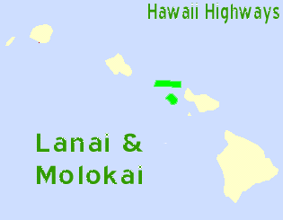
Click here for
zoomable Google road map of Lanai
Click here for zoomable Google road map of Molokai
(consult route lists below for updated and detailed route information)
. State route; State route;  County route; County route;   Former route; Former route;  Other unnumbered route Other unnumbered route
(Actual county route shields are usually identical to state shields; see the FAQs for
how routes are classified in the listings below.
Also, in many browsers letting your mouse linger over a route number graphic will help you decipher it.)
| Former
route (no longer in numbered state or county system) |
Routes are listed in numerical order.
For lists ordered differently (by name in alphabetical order, or by former
route number):
Name
cross-index · Former
route cross-index
| Lanai |
| Route |
Name |
Termini/misc
road info |
Mileage |
Former

(part) |
Kaumalapau
Highway
(part) |
JN  Kaumalapau Highway just west of Fraser Avenue in Lanai City, east to JN Kaumalapau Highway just west of Fraser Avenue in Lanai City, east to JN  Lanai Avenue; as of October 1999 and November 2001, no route markers or milemarkers Lanai Avenue; as of October 1999 and November 2001, no route markers or milemarkers |
0.2
miles |
Former
(part) |
Lanai
Avenue |
JN Kaumalapau Highway, north through Lanai City to JN Keomuku Road near the Lodge at Koele; former part of Kaumalapau Highway; was part of numbered Federal-aid numbered highway system under county jurisdiction in 1962, but unclear when it was deleted from system, or became an unnumbered road (probably around 1967); as of October 1999 and November 2001, no route markers or milemarkers |
1.2
miles |
Former
(part)Former
County
 |
Keomuku
Road
(part) |
JN Lanai Avenue, in Lanai City near The Lodge at Koele, northeast to end of pavement at mile 7.2 near coast at Kahokunui, then south along coast on narrow unpaved road past old Keomuku village and Kahea Gulch to near Halepalaoa Landing; former part of Kaumalapau Highway; rough dirt road continues about 3 miles along coast south of Halepalaoa Landing; was part of numbered Federal-aid numbered highway system under county jurisdiction in 1962, but unclear when it was deleted from systems, or became an unnumbered road (probably around 1967); by 1981, at least the first 2.2 miles (west of Mahana Trail) become Maui County route 430; as of October 1999 and November 2001, no route markers or mile markers |
~15
miles(last
~8
miles
unpaved) |
| 4x4 needed for unpaved
portions, especially when road is wet. |

(part) |
Kaumalapau
Highway
(part) |
Kaumalapau Harbor, east to JN Kaumalapau Higbway Manele Road in Lanai City; completed in 1961; part of former route 44 |
6.0
miles |
| Photos |
(part) |
Manele
Road |
JN Kaumalapau Highway at Lanai City, south to entrance of Hulopoe Beach Park near Manele Bay; former county route 441 |
8.2
miles |
 |
Lanai
Airport
Road |
JN Kaumalapau Highway between Kaumalapau Harbor and Lanai City, south to
Lanai Airport; former county route 443; may be unsigned |
0.5
miles |
 |
Kaumalapau
Highway
(part) |
JN Kaumalapau Highway and Manele Road in Lanai City, east to
Kaumalapau Highway just west of intersection with Fraser Avenue; part of former route 44; may be unsigned |
< 0.1
miles |
| Molokai |
| Route |
Name |
Termini/misc
road info |
Mileage |
Former

? |
See listing after   listings below listings below |
 |
Kamehameha
V Highway |
JN  Maunaloa Highway and Kaunakakai Place in Kaunakakai, east to end of pavement
at Halawa Valley; named for the last king of the Kamehameha dynasty, who liked to vacation on Molokai Maunaloa Highway and Kaunakakai Place in Kaunakakai, east to end of pavement
at Halawa Valley; named for the last king of the Kamehameha dynasty, who liked to vacation on Molokai |
27.5
miles |
| Photos |
Highway east of mile 20 is narrow and winding. |

(part) |
Kaunakakai
Place |
Kaunakakai Harbor wharf, north to JN Maunaloa Highway  Kamehameha V Highway in Kaunakakai; part of former route 46 Kamehameha V Highway in Kaunakakai; part of former route 46 |
0.3
miles |
(part) |
Maunaloa
Highway |
JN Kaunakakai Place Kamehameha V Highway in Kaunakakai, west to "End State Highway" sign at Maunaloa village entrance; former route 46, at least west to Mokulele Avenue |
16.3
miles |
 |
Airport Loop
Road
(west end
also Launui
Street) |
JN Maunaloa Highway east of Hoolehua Airport, past airport entrance, to JN west of airport; no route shields or milemarkers; street sign at east end calls road Airport Loop, but parallel sign at other end calls it Launui Street (Hawaii DOT route log calls entire road Airport Loop Road) |
2.1
miles |
 |
Kalae
Highway |
JN Maunaloa Highway north to entrance to parking lot for Kalaupapa Lookout in Palaau State Park; northernmost 1.7 miles transferred from county to state jurisdiction sometime in 1960s, and upgraded to paved road in May 1972 (before then, road was sometimes impassible to non-4x4s); former route 47 (south of Farrington Avenue), and 47 or 47B (north of Farrington Avenue) |
5.8
miles |

(part) |
Farrington
Avenue
(part) |
JN  Kalae Highway to JN Kalae Highway to JN  Puupeelua Avenue Farrington Avenue; originally part of route 48 Puupeelua Avenue Farrington Avenue; originally part of route 48 |
2.4
miles |
(part) |
Puupeelua
Avenue
(part) |
JN Puupeelua Avenue Farrington Avenue, south to JN Maunaloa Highway; originally part of route 481 |
1.2
miles |
Former
County
 |
Farrington
Avenue
(part) |
JN Farrington Avenue and Puupeelua Avenue Puupeelua Avenue, west to  Farrington Avenue about 0.2 miles east of Anahaki Road; apparently transferred from state to county jurisdiction in 1968, but not included in 1981 county route log, nor were there any route markers or milemarkers west of Puupeelua Avenue; used to be part of route 48 and/or 480 Farrington Avenue about 0.2 miles east of Anahaki Road; apparently transferred from state to county jurisdiction in 1968, but not included in 1981 county route log, nor were there any route markers or milemarkers west of Puupeelua Avenue; used to be part of route 48 and/or 480 |
3.1
miles |
Former
? |
Farrington
Avenue
(part)/
Moomomi
Road |
JN Farrington Avenue about 0.2 miles east of Anahaki Road, changing name after about 0.5 miles to Moomomi Road, then continuing west to end of road at Kawaaloa Bay; unpaved road, reportedly rough but passable; only documentation I have seen that this ever was a numbered road is a 1977 Hawaii Visitors Bureau map |
~ 2.5
miles |
County
 |
Puupeelua
Avenue
(part) |
JN Puupeelua Avenue and Farrington Avenue Farrington Avenue, north to JN Puu Kapele Avenue; no route signage, except junction markers at south end on intersecting Farrington Avenue |
0.6
miles |
County

(part) |
Lihi Pali
Avenue (part) |
JN Farrington Avenue, west to JN Puu Kapele Avenue at turnoff for two cemeteries; part of former route 482; no route signage |
1.0
miles |
County
(part) |
Puu Kapele
Avenue (part) |
JN Lihi Pali Avenue, west to Nenehanaupo Avenue; route originally planned to continue 1.4 miles to Hauakea Avenue, but road continuing straight from west end of Puu Kapele Avenue pavement is only short unpaved driveway curving southwest to private residence, and Hauakea Avenue also was never completed north to where it would have met Puu Kapele Avenue; however, apparently unbuilt segment of Puu Kapele Avenue is paralleled by ~1.5 mile one-lane paved driveway jogging north off Puu Kapele/Nenehanaupo intersection, then west to small Air Force space communications facility (some maps show this driveway as part of Puu Kapele Avenue, but that is not indicated by street signage at Puu Kapele/Nenehanaupo intersection); only route signage is milemarker 2 indicating route number; part of former route 482 |
1.6
miles(+ 1.4
miles
unbuilt?)
|
Links to main page
and other parts of Hawaii Highways site, and related sites:
© Oscar Voss/C.C. Slater 1997-2007, 2010. Last updated June 2012. See update status list for the latest field check and review of Hawaii DOT records.
Comments, questions, etc.? Please e-mail me. |