| Hawaii Highways road photos -- Other Big Island
(Big Island part 6 of 6 -- other
Big Island parts: Saddle Road ·
Observatories Roads ·
Lava Closures · Red Road · Waipio Valley)
The following miscellaneous photos are from all around Hawaii's Big Island, and cover highways not featured in the other Big Island parts of the road photos collection. All photos on this page are my own, unless otherwise noted. Many on the second half of this page are courtesy of Tim Reichard, from his January 2005 visit to the Big Island. Many more of his photos will be added in the next few months; when they are, this page will be reorganized and probably split into three or four separate pages, to make room for them all (this page is pretty long and crowded as is).
NOTE: In case you want more detail, clicking some of the photos below will call up enlarged, higher-quality (less .jpg compression) versions. Those alternate versions have larger file sizes, so please be patient while they download.
 |
 |
 Ka Lae, the southernmost point in the United States (next land to the south is about 7500 miles on the Antarctic coast), and believed to be where Hawaii's original Polynesian settlers first landed. Rental car companies dislike the 12-mile South Point Road to Ka Lae (unnumbered county road, paved but mostly one-lane), but don't let that stop you! Ka Lae, the southernmost point in the United States (next land to the south is about 7500 miles on the Antarctic coast), and believed to be where Hawaii's original Polynesian settlers first landed. Rental car companies dislike the 12-mile South Point Road to Ka Lae (unnumbered county road, paved but mostly one-lane), but don't let that stop you!
South Point Road forks about 10 miles south of state route 11. Going straight ahead (rather than right to Ka Lae) takes you to the trailhead to ... (October 1999)
|
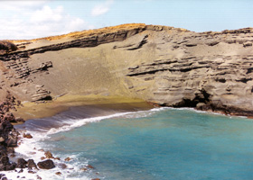
Green Sand Beach, in a collapsed crater a few miles east of Ka Lae. The sand is green because of the crater's high olivine content. The beach is about an hour's hike from the nearest road (the jeep road along the coast to the beach was recently closed to motor vehicles -- but some 4x4s go there anyway),
which helps hold down the crowds. The trails down to the beach are also tricky, so good shoes and a walking stick would help you get down there from the top of the cliff. (October 1999)
|
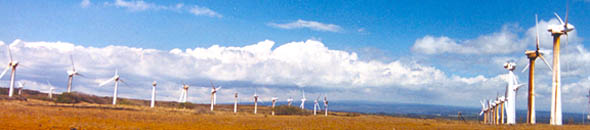 |
The windmill farm on South Point Road, on the way to Ka Lae and Green Sand Beach. (May 2000)
|
|
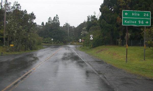
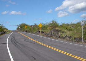
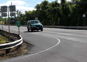
 On the Mamalahoa Highway (here part of state route 11) as it passes between the Kilauea and Mauna Loa volcanoes. This happens to be relatively safe (for the southern half of the Big Island) from lava flows, since it's uphill from the Kilauea caldera, and the terrain above the road helps divert lava from Mauna Loa well away from the road. But there's no protection from the many (but usually small) earthquakes emanating from both volcanoes. (May 2000) On the Mamalahoa Highway (here part of state route 11) as it passes between the Kilauea and Mauna Loa volcanoes. This happens to be relatively safe (for the southern half of the Big Island) from lava flows, since it's uphill from the Kilauea caldera, and the terrain above the road helps divert lava from Mauna Loa well away from the road. But there's no protection from the many (but usually small) earthquakes emanating from both volcanoes. (May 2000) |
 |
 |
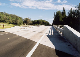
| A new bridge on the Mamalahoa Highway (part of state route 11 here as well) east of Pahala, at mile 50.4, to replace one washed out by floods the year before. (November 2001) |
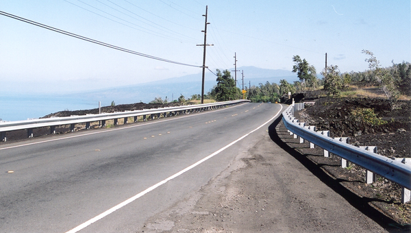
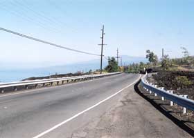
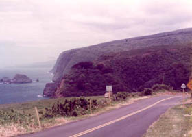
A scenic view from the Mamalahoa Highway (still part of state route 11) along the coast, about 30 miles south of Kailua-Kona, at mile 92.9 northbound. (November 2001)
|
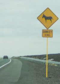
 The Queen Kaahumanu Highway (part of state route 19), north of the Kailua-Kona airport, passes through the stomping grounds of a herd of wild donkeys. (October 1999, courtesy of Mark and Sue Pelletier) The Queen Kaahumanu Highway (part of state route 19), north of the Kailua-Kona airport, passes through the stomping grounds of a herd of wild donkeys. (October 1999, courtesy of Mark and Sue Pelletier) |
|
|
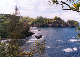
Onomea Bay north of Hilo, along a scenic drive off Hawaii Belt Road (another part of state route 19). (May 2000) |
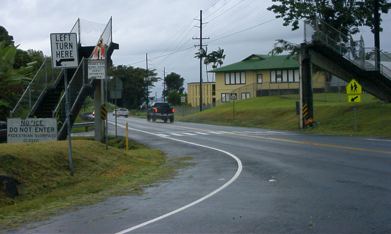
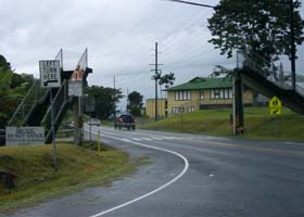
Hawaii Belt Road southbound, at the turnoff to the Onomea Bay scenic drive. Just past the turnoff are the remnants of a dismantled pedestrian overpass. (September 2007, courtesy of Kees Plug)
|
|
 |
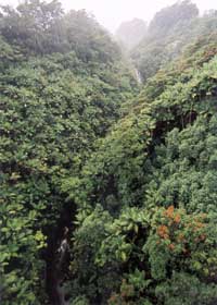 |
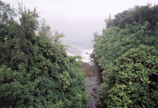
Further north on Hawaii Belt Road (part of state route 19), at mile 18.4, is the Nanue Bridge, a converted railroad bridge, and highest bridge in Hawaii at about 208 feet above Nanue Stream. I couldn't find a good vantage point to photograph the bridge itself, but I did shoot these views from the center of the bridge, using an ultra-wide angle lens to take photos covering all the scenery from the horizon to almost right under the bridge. The photo above left is toward the mist-covered ocean, and the outlet of Nanue Stream. Above right is the view inland, including one of the waterfalls on Nanue Stream. (Both photos November 2001)
|
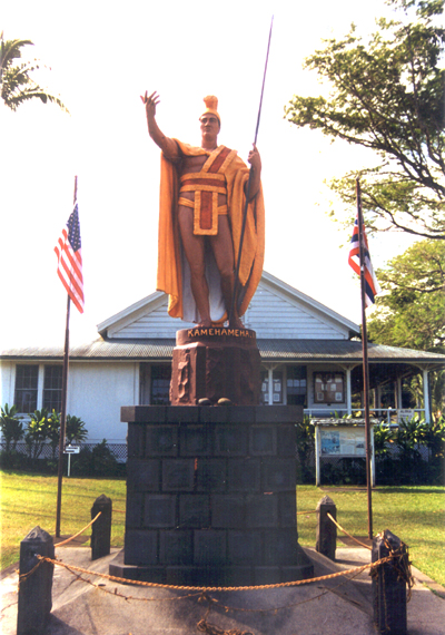
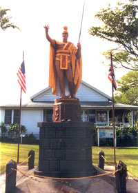
This statue of Kamehameha the Great is along Akoni Pule Highway (state route 270) in Hawi at the northern tip of the Big Island, near his birthplace. There are two similar statues (though not painted in earth tones like this one) of the first ruler of all the Hawaiian islands -- one across the street from the Iolani Palace in downtown Honolulu, the other in Statuary Hall in the U.S. Capitol. (October 1999) |
|
|
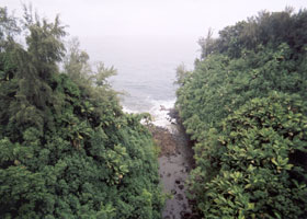
Akoni Pule Highway (state route 270) approaching the Polulu Valley, near the highway's end east of Hawi. (Courtesy of Mike Wiley.)
|
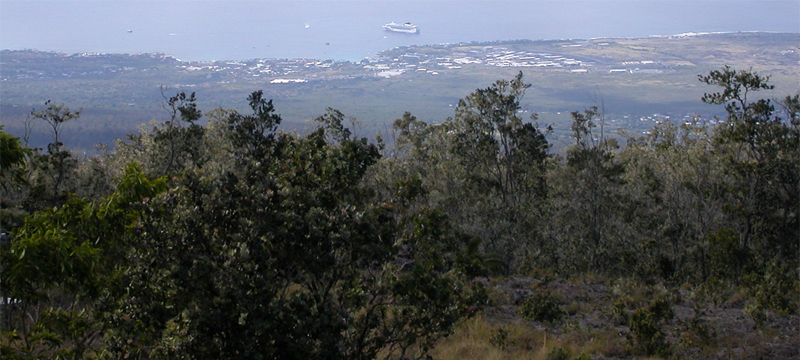
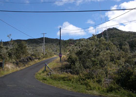
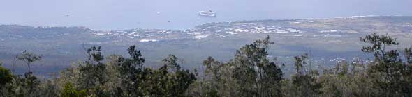
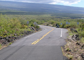
 Kalako Drive starts at the Mamalahoa Highway (there part of state route 190) northeast of Kailua-Kona, near mile 34. It zigzags about 3000 feet up the west slope of the now-quiet Hualalai volcano to an elevation of about 4500 feet. The road is paved, but parts are narrow (right). It ends with scenic overviews, such as the one shown below of Kailua-Kona (with a large cruise ship offshore). (January 2005, courtesy of Tim Reichard) Kalako Drive starts at the Mamalahoa Highway (there part of state route 190) northeast of Kailua-Kona, near mile 34. It zigzags about 3000 feet up the west slope of the now-quiet Hualalai volcano to an elevation of about 4500 feet. The road is paved, but parts are narrow (right). It ends with scenic overviews, such as the one shown below of Kailua-Kona (with a large cruise ship offshore). (January 2005, courtesy of Tim Reichard) |
 |
|
 |
 |
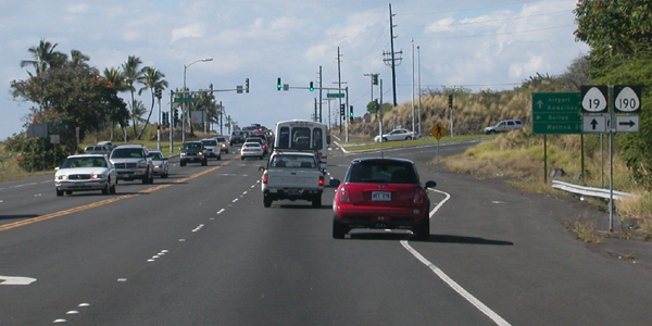
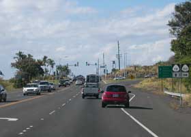
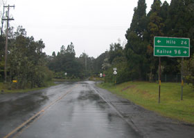
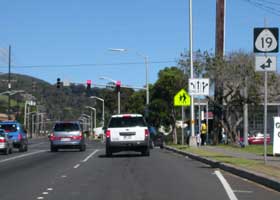
Both photos above are of the intersection of Queen Kaahumanu Highway with Palani Road (state route 190) just east of downtown Kailua-Kona. The photo above left shows the northbound highway approaching the intersection, where state route 11 ends after it traverses the south side of the Big Island from its origin in Hilo. Above right is the other side of the intersection, where state route 19 ends after it starts in Hilo (less than a mile east of its eastern junction with route 11), and loops around the north side of the island. (Both photos January 2005, courtesy of Tim Reichard)
|
|
The south end of county route 148 is here at the T-intersection of Wright Road with Volcano Road (part of state route 11), in Volcano village north of Hawaii Volcanoes National Park. (January 2005, courtesy of Tim Reichard)
|
State route 160, Ke-ala-o-Keawe Road, is a spur from the Mamalahoa Highway (here part of state route 11) to Puuhonua O Honaunau National Historical Park (an ancient Hawaiian "city of refuge," where the violators of even the most serious "kapu" or taboos could get swift absolution if they could make it inside before being killed by their pursuers). This photo shows the east end of the highway, at the junction with state route 11. (January 2005, courtesy of Tim Reichard)
|

|
 |
 |
State route 160 ends just north of the national park entrance, but the road continues as county route 160, with a new name (Puuhonoa Road) and pavement little more than one lane wide. The photo above left shows the west end of state route 160, as it turns into county route 160; above right is the south end of county 160, where it continues onto state route 160. (Both photos January 2005, courtesy of Tim Reichard)
|
 |
 |
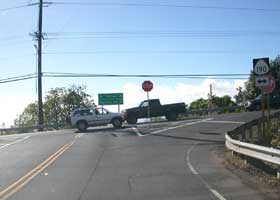
The south end of county route 180 is here, where the short Haawina Street connector, from Mamalahoa Highway on its way through the highlands above Kailua-Kona, meets Kuakini Highway (part of state route 11) south of Kailua-Kona (above left). Mamalahoa Highway continues about another two miles south of Haawina Street, to meet route 11. However, the zero milepost at the Haawina Street junction with route 11 (above right) confirms that county route 180 ends there rather than further to the south. (Both photos January 2005, courtesy of Tim Reichard)
|
|
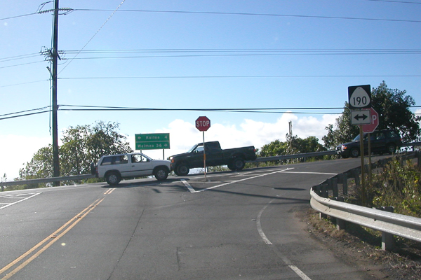
The other end of county route 180 (part of Mamalahoa Highway) is more straightforward, here at the T-intersection with state route 190 northeast of Kailua-Kona. Mamalahoa Highway continues right past this junction; route 190 to the left of the junction is Palani Road, dropping down toward downtown Kailua-Kona. (January 2005, courtesy of Tim Reichard)
|
 |
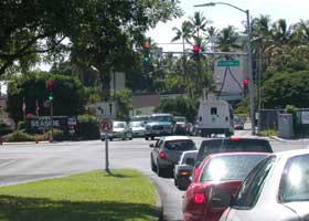 |
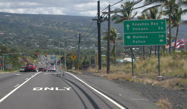
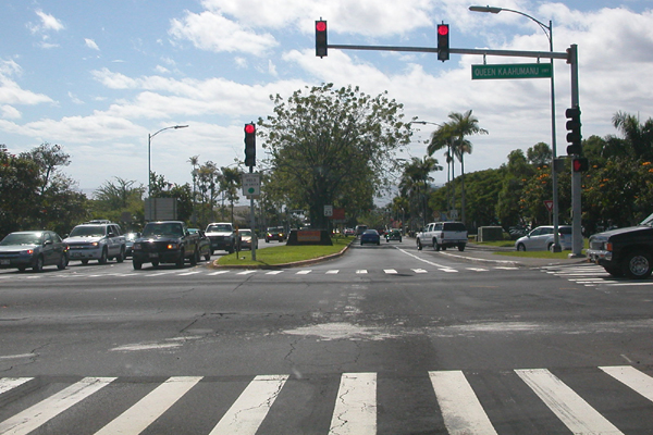
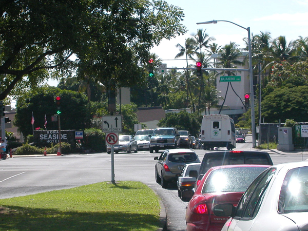
Palani Road (part of state route 190) descends from the Mamalahoa Highway junction into downtown Kailua-Kona. The photo above left shows its intersection westbound with Queen Kaahumanu Highway (state route 11 to the left, state route 19 to the right). The junction signs on both directions of Queen Kaahumanu Highway notwithstanding (see the other QKH-Palani Road junction photos above), as far as I know state route 190 technically continues about a half-mile more through downtown Kailua-Kona, where it ends at the intersection of Palani Road with Kuakini Highway (former state route 11 to the left), with Ali'i Drive (county route 187) continuing on the other side of the intersection, as shown in the photo above right. (Both photos January 2005, courtesy of Tim Reichard)
|
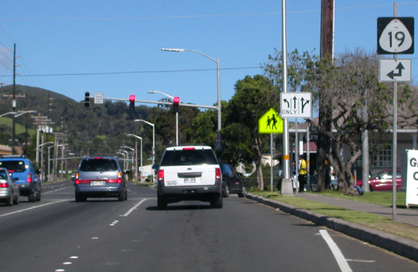
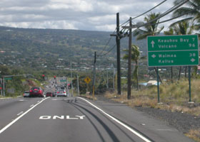
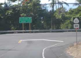
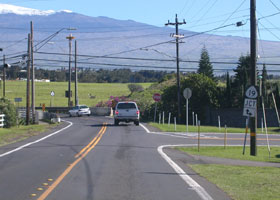
The north end of state route 190 (here part of Mamalahoa Highway) is in downtown Waimea, where it meets state route 19. Route 19 is Kawaihae Road to the left, toward the coast. Mamalahoa Highway continues straight ahead through this intersection as route 19, until about five miles northeast of Waimea where route 19 switches over to the newer and straighter Hawaii Belt Road almost all the way back to Hilo. (January 2005, courtesy of Tim Reichard)
|
|
 |
 |
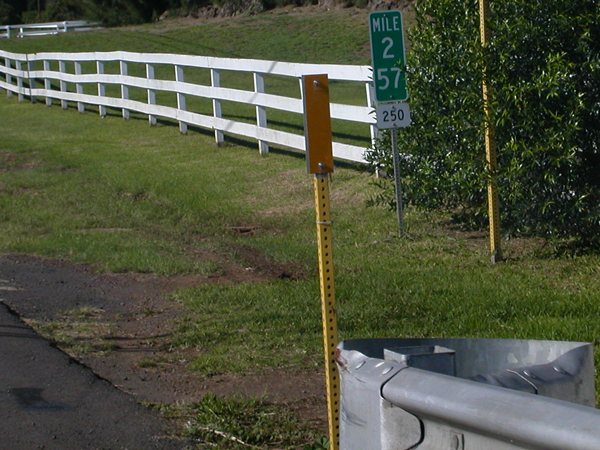
| The southern end of state route 250 (Kohala Mountain Road, here and most of the rest of the way north into Hawi) is here at the junction with state route 19 (Kawaihae Road), east toward Waimea to the left and right toward Kawaihae to the right. A glimpse of the snow-covered Mauna Kea summit can be seen in the background. (January 2005, courtesy of Tim Reichard) |
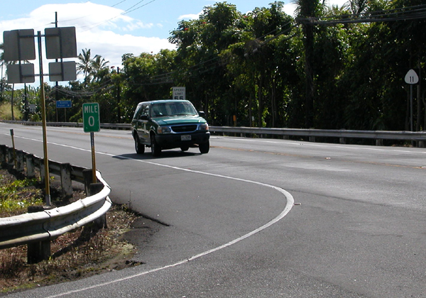
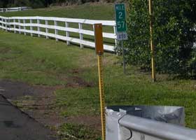
The terminal milepost at that junction is mile 2.57, rather than the expected mile 0. Route 250 used to continue 2.57 miles into Waimea, but that part of the route was absorbed by route 19 when the latter was rerouted over to the Queen Kaahumanu Highway along the coast, away from the old inland Mamalahoa Highway alignment which is now part of state route 190. (January 2005, courtesy of Tim Reichard)
|
|
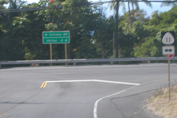
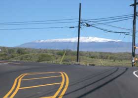
State route 270, here part of Kawaihae Road, joins at this intersection with the rest of Kawaihae Road (part of state route 19) to the left, and Queen Kaahumanu Highway toward Kailua-Kona (also part of state route 19) to the right. In the background is the summit of Mauna Kea ("white mountain") in the winter. (January 2005, courtesy of Tim Reichard)
|
 |
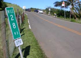 |
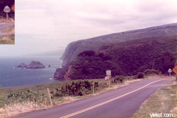
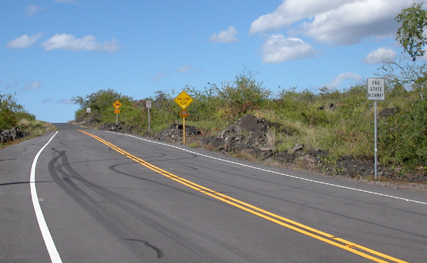
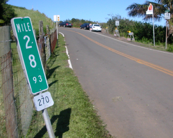
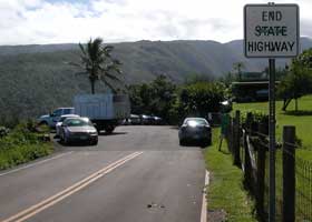
| Most of the rest of state route 270 is the Akoni Pule Highway, following the coastline of the Kohala Peninsula. Its northeastern end is here at the parking area for the trailhead down into the Polulu Valley, viewed from the west (above left), and from the parking area back to where route 270 starts, with the terminal milepost on the left indicating the exact route end and the ending mileage (above right). (Both photos January 2005, courtesy of Tim Reichard) |
See also Mark Furqueron's Hawaii road photos page for some more Big Island road photos.
This is the end of the Hawaii Highways road photos collection.
You may also return to other parts of the collection:
Overview · Introduction ·
Interstate H-3 · Interstate
H-1 · Other Freeways
Other Oahu South · Other
Oahu West · Other Oahu East · Kuhio Highway
Other Kauai · Hana
Highway · Piilani Highway ·
Kahekili Highway · Other Maui
Lanai/Molokai · Kalawao
County · Saddle Road · Observatories Roads
Lava Closures · Red Road
or to other sections of the Hawaii Highways site:
Comments, etc.? Please e-mail me.
© 1999-2005, 2007 Oscar Voss.
|