| Hawaii Highways road photos --
Other Oahu West
(Oahu part 5 of 6 -- other Oahu
parts: Interstate H-3 ·
Interstate
H-1 ·
Other
Freeways · Other
Oahu South · Other
Oahu East)
Here are nine photos, covering non-Interstate roads
and highways on the west side of Oahu, especially the legendarily bad road
that used to round the island's northwest corner at Kaena Point.
NOTE: In case you want more detail, you can click many of
the photos below (for now, most of the 2001 photos) to view an enlarged,
higher-quality (less .jpg compression) version. Those alternate versions
have larger file sizes, so please be patient while they download.
 |
 |
|
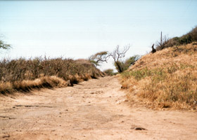
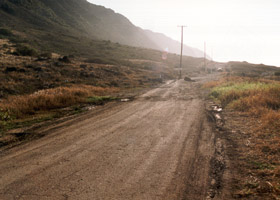
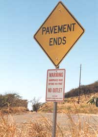
  The west (left and above left) and east (above right) ends of the rough
unpaved portion of the old Farrington Highway around Kaena Point, which
used to "connect" what now are state routes 93 and 930. Motor vehicles can no longer
travel around Kaena Point (but hiking is possible), due to a landslide
which took out part of the road, and a newly-established nature preserve
that also closed off the road right around Kaena Point. (Photos above September
1999; photo on left November 2001)
The west (left and above left) and east (above right) ends of the rough
unpaved portion of the old Farrington Highway around Kaena Point, which
used to "connect" what now are state routes 93 and 930. Motor vehicles can no longer
travel around Kaena Point (but hiking is possible), due to a landslide
which took out part of the road, and a newly-established nature preserve
that also closed off the road right around Kaena Point. (Photos above September
1999; photo on left November 2001) |
 |
 |
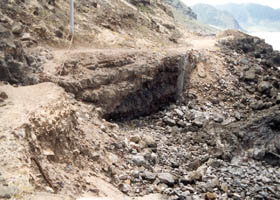
| Here is the
landslide southeast of Kaena Point that helped close the old Farrington
Highway. (May 2000) |
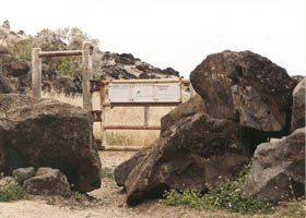
This gate,
and the wall of boulders on either side, east of Kaena Point (on the north
shore approach to the point) block motor vehicle access to the Kaena Point
area. (May 2000)
|
 |
 |
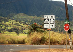
| Here the Farrington
Highway section along Oahu's north shore (state route 930), east of Kaena
Point, meets Kaukonahua Road toward Wahiawa (former county route 803, the stray old
route marker notwithstanding). (September 1999) |
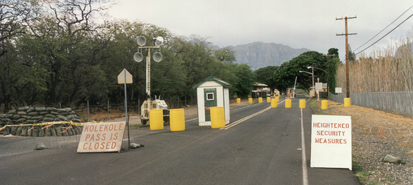
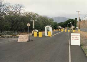
Lualualei
Naval Road/Kolekole Pass Road (part of former route 78) long ago let civilians travel between the west coast of Oahu and central Oahu via Kolekole Pass, but is now
closed to civilian traffic. West coast residents could use an alternate route
to their only way out now, the Farrington Highway (state route 93)
south to Interstate H-1, which is sometimes closed by water main breaks
or other emergencies. However, the military is understandably reluctant
to allow civilian travel over Kolekole Pass and through the Lualualei naval ammunition depot to the west, especially after 9/11. State and county officials are woking on other alternatives, including upgrading some unpaved back roads paralleling the Farrington Highway, and perhaps ultimately a new road tunnel through the Waianae Range. (November 2001) |
 |
 |
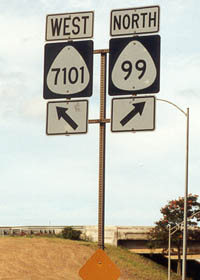
| An example
of a shield for Hawaii's usually unsigned 4-digit state routes, this one
at the southern junction of Oahu's Farrington and Kamehameha Highways (routes
7101 and 99 respectively). Hawaii's 4-digit routes are mainly on Oahu (often
but not always near military facilities), and usually are minor roads that
otherwise would not be in the state highway system. (May 2000) |
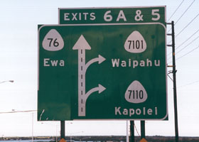
The exit sign
on southbound Fort Weaver Road (state route 76), at its intersection with
the Farrington Highway north of Ewa. Oddly, the route numbers are better
signed on this exit sign than on the roads at the end of the exit ramps.
The last time I was there, the route number was not signed at all on the
0.6 miles of route 7110 to the west, and except for the sign shown in the
photo above left, was also unsigned on route 7101 to the east. (September
1999)
|
Go to the previous or next parts of the Hawaii Highways road photos
collection:
or directly to other parts:
Overview · Introduction
· Interstate H-3 · Interstate H-1 · Other Freeways
Kuhio Highway · Other Kauai
· Hana Highway · Piilani
Highway
Kahekili Highway · Other
Maui · Lanai/Molokai · Kalawao County
Saddle Road · Observatories Roads · Lava Closures · Red Road
Waipio Valley · Other
Big Island
or to other sections of the Hawaii Highways site:
Comments, etc.? Please e-mail me.
© 1999-2004 Oscar Voss. |