| Hawaii Highways
road photos -- Kahekili Highway
(Maui part 3 of 4 -- other Maui parts:
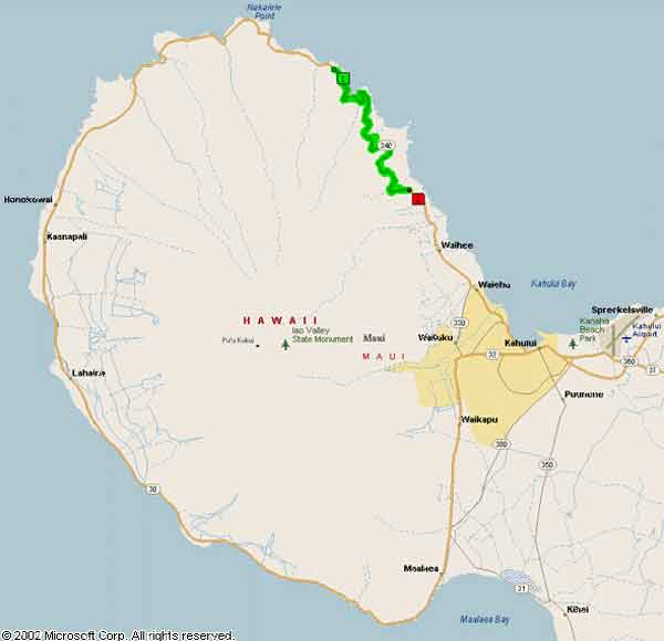
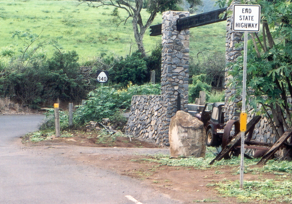
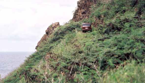
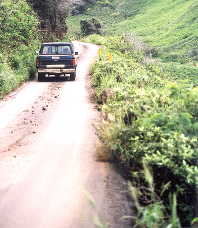
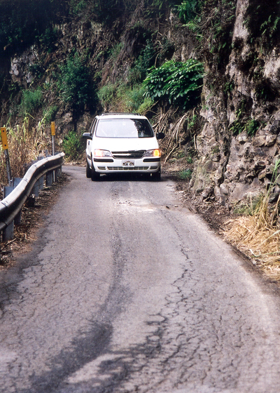
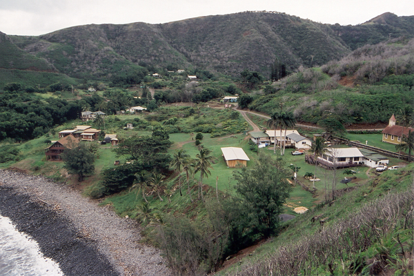
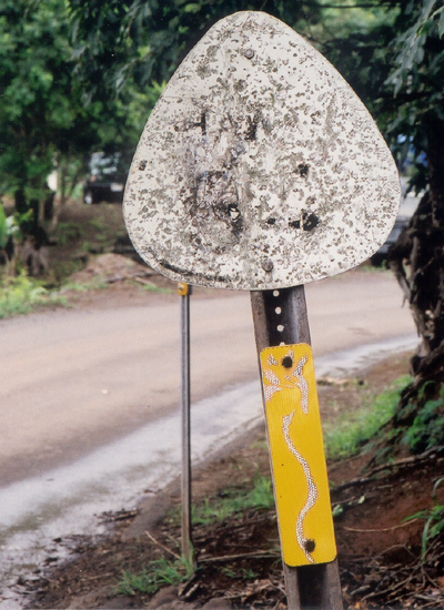
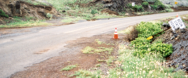
Below are 14 photos of the scenic but notoriously narrow and twisty county-maintained section of the Kahekili Highway (county route 340) along Maui's northwest coast, between the changeover from state to county maintenance at mile 6.9, and where the highway ends at mile 16.3 to become the Honoapiilani Highway (state route 30). (Most of the rest of the Kahekili Highway, southeast to Wailuku, is an unexceptional state highway, state route 340.) Unless otherwise noted, these photos were taken on my November 2001 visit to Maui. It wasn't until sometime in the 1990s that this road was completely paved, and open to travel for rental cars (though some companies may still place it off-limits, so visitors should check their rental contracts). Even now, it remains a little-used "back door" into west Maui (for good reason, as shown below). Occasionally, it is pressed into service as an alternate access route to and from west Maui, whenever a serious accident blocks the other road into west Maui, the two-lane Honoapiilani Highway along the southwest coast (which happens several times a year) -- much to the distress of the residents of Kahakuloa village, who depend on the Kahekili Highway as their only access to the rest of Maui, and have a hard time getting in or out when the highway is tied up with diverted Honoapiilani Highway traffic. Some have suggested widening the Kahekili Highway to provide a better alternate route to and from west Maui. I'm not wild about that idea -- while I haven't studied the alternatives in depth, it seems to me it would probably be better to make the Honoapiilani Highway a four-lane divided highway so it is less vulnerable to accident closures (or at least build emergency bypasses on old cane haul roads, to detour traffic around accidents), than to spend a lot of money improving the Kahekili Highway. NOTE: In case you want more detail, clicking most of the photos below will call up enlarged, higher-quality (less .jpg compression) versions. Those alternate versions have larger file sizes, so please be patient while they download. Warnings: As illustrated below, the county-maintained portion of the Kahekili Highway is narrow, twisty, and very slow (speed limits usually 15 mph or slower), with many one-lane stretches, and often with minimal reflectorization and guardrails. Driving at night, or in poor visibility, is not recommended for drivers unfamiliar with the road. Some rental car companies may prohibit driving their vehicles on this road. Also, the last ten miles of the Honoapiilani Highway (state route 30), west from the Kahekili Highway toward Kaanapali, are narrow and winding (though not quite as slow as county route 340). Even in broad daylight, don't even think of using this route as a "shortcut" between the resorts in west Maui and the airport in Kahului. State route 30 via Maui's southwest coast will almost always be much faster and more comfortable, even if the mileage is substantially longer. Drive this route only if you have time to spare, for the scenery or to visit a destination along the highway such as Kahakuloa village. Map of western Maui, with county route 340 highlighted:
Go to the previous or next parts of the Hawaii Highways road photos collection:
Overview ·
Introduction
·
Interstate H-3 ·
Interstate H-1 · Other
Freeways
or to other sections of the Hawaii Highways site:
Comments, etc.? Please e-mail me. © 1999-2003, 2006 Oscar Voss. |
||||||||||||||||||||||||||||||||||