| Hawaii
Highways road photos -- Kuhio Highway
(Kauai part 1 of 2 -- other Kauai
part: Other Kauai)
Below are about a dozen and a half road photos from the Kuhio Highway, comprising state
highway 56 from Lihue to Princeville, and state route 560 (added in 2004 to the National Register of Historic Places) west of Princeville. All photos were taken on my September 1999, November 2001, and June 2005
visits to the island. A separate page covers
other parts of Kauai.
NOTE: In case you want more detail, clicking many of the photos
below (for now, just ones from my 2001 and 2005 trips) will call up enlarged, higher-quality
(less .jpg compression) versions. Those alternate versions have larger
file sizes, so please be patient while they download.
 |
 The Kuhio
Highway starts off as state route 56 heading north out of Lihue. Near mile 5.8,
the northbound lanes of the highway split, to cross the Wailua River (Hawaii's only navigable river) on both part of the main two-lane highway bridge, and a parallel old cane haul road bridge converted to provide an
additional lane northbound. The state has since temporarily closed the cane haul bridge so it can be widened to two lanes (plus a bike/pedestrian path), with construction expected to be completed in summer 2010. (June 2005) The Kuhio
Highway starts off as state route 56 heading north out of Lihue. Near mile 5.8,
the northbound lanes of the highway split, to cross the Wailua River (Hawaii's only navigable river) on both part of the main two-lane highway bridge, and a parallel old cane haul road bridge converted to provide an
additional lane northbound. The state has since temporarily closed the cane haul bridge so it can be widened to two lanes (plus a bike/pedestrian path), with construction expected to be completed in summer 2010. (June 2005)
|
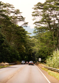
 State route 56 westbound
near mile 25, on Kauai's north shore before it narrows to a secondary highway
and becomes state route 560 in Princeville. (September 1999) State route 56 westbound
near mile 25, on Kauai's north shore before it narrows to a secondary highway
and becomes state route 560 in Princeville. (September 1999) |
|
 |
Just a little
more to the west, near mile 25.5 on route 56, this bridge sweeps over Kalihiwai
Stream. This bridge is part of a bypass, completed in the early 1960s, of an old alignment
running closer to the shore, with its own bridge over Kalihiwai Stream destroyed in a 1957 tsunami. That bridge was temporarily replaced until the bypass was built, but the temporary span was removed thereafter, so the old road is now closed to through traffic. (September 1999)
|
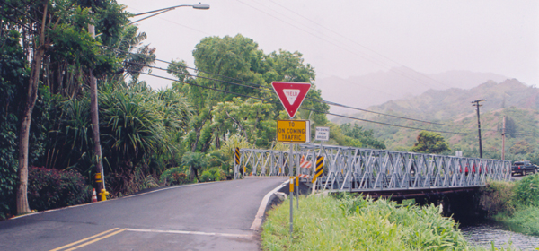
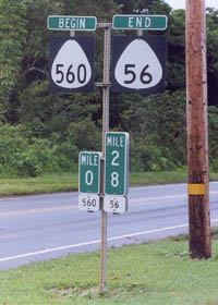
Here in Princeville,
the Kuhio Highway changes route numbers, to reflect the road's change from
a primary route to a lower-quality secondary route. The highway beyond this point
was added in 2004 to the National Register of Historic Places. The milemarkers (zero milemarker at the start of route 560, route numbers on white plates
below both markers) follow the standard Hawaiian road sign style. However,
"end" signs are uncommon in the islands, and "begin" signs are used only
on Kauai. (November 2001) |
|
|
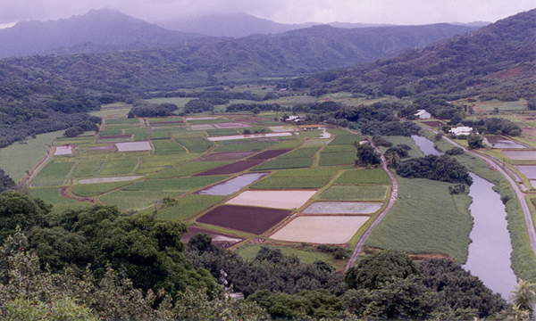
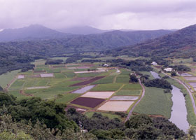
 In Princeville, at
mile 0.1 on the state route 560 portion of the Kuhio Highway, the Hanalei
Valley Lookout offers a great view to the south of the valley's inland fields,
along with the Hanalei River to the right. (November 2001) In Princeville, at
mile 0.1 on the state route 560 portion of the Kuhio Highway, the Hanalei
Valley Lookout offers a great view to the south of the valley's inland fields,
along with the Hanalei River to the right. (November 2001) |
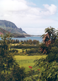
The turnout at mile
0.6 just down the road offers a still more gorgeous view to the west of
the coastal end of the Hanalei Valley. (September 1999) |
|
 |
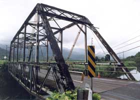 |
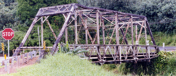
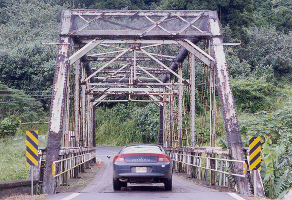
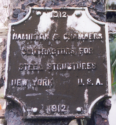
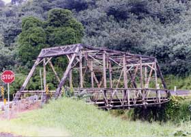
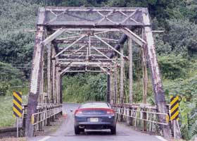
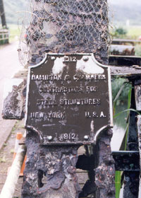
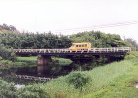
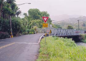
 Several views of the historic Hanalei Bridge taking the Kuhio Highway over
the Hanalei River at mile 1.2 of state route 560, before its 2003 restoration. Like most of the
bridges on the route 560 segment of the highway, the bridge is only one
lane wide. (All four photos November 2001)
Several views of the historic Hanalei Bridge taking the Kuhio Highway over
the Hanalei River at mile 1.2 of state route 560, before its 2003 restoration. Like most of the
bridges on the route 560 segment of the highway, the bridge is only one
lane wide. (All four photos November 2001)
NOTE: This bridge was restored in 2003, with the original 1912 rusted steel truss replaced with a similar new black steel structure, and a reinforcing truss that had been added under the deck in the 1960s repaired and retained. See an article in the November 9, 2003 (Kauai) Garden Island newspaper, and another article in the May 14, 2003 edition of that paper, for more information including photos of the restored bridge. |
 |
|
|
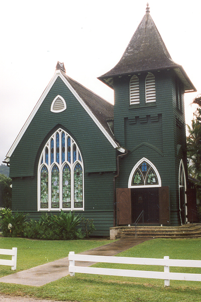
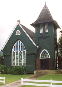
The charming Wai'oli
Hui'ia Church in Hanalei village, along route 560 at mile 3.0. (November 2001) |
 |
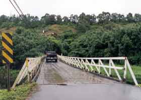 |
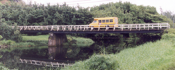
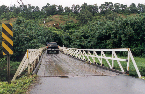
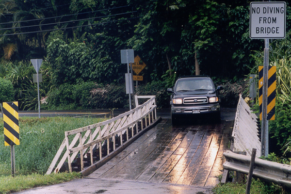
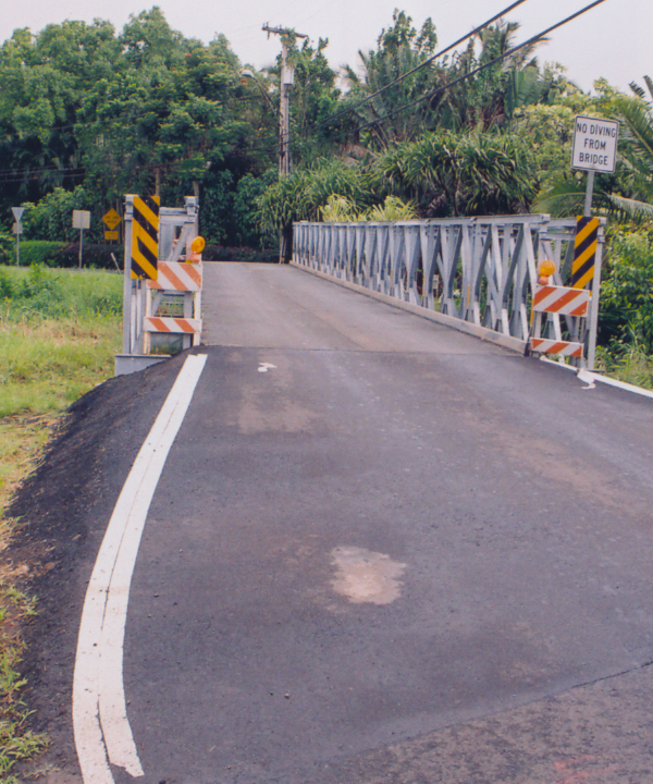
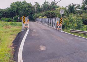
Here the Kuhio Highway, at mile 6.6 of state route 560, crosses the Wainiha
River on narrow one-lane wood-decked bridges, the main bridge
(above left and right), and a shorter bridge across a slough just to the
east (right). Both bridges, as well as all the others west of Hanalei, have low weight limits (one of these has a six-ton limit). (All photos November 2001)
|
|
 |
 |
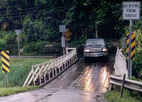
The shorter Wainiha bridge shown above has since been covered by a temporary steel superstructure, to bear loads pending permanent repairs to the original bridge. (Both photos June 2005)
|
 |
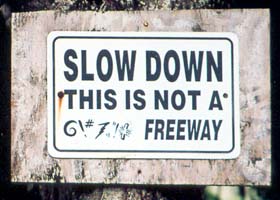 |
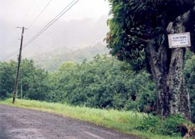
I guess there have been problems with speeders on this dirt road, Ana Eke Road, branching off the Kuhio Highway, just east of the main Wainiha River crossing, to prompt this very unofficial caution sign. (Both photos June 2005)
|
|
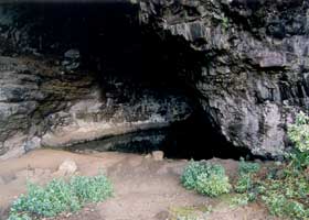
Waikapala'e Wet Cave,
at mile 9.9 of state route 560 near the west end of the Kuhio Highway,
looks inviting but is posted "no swimming." Besides, it's only a little
longer to Ke'e Beach just after the end of the highway. (November 2001) |
Go to the previous or next parts of the Hawaii Highways road photos
collection:
or directly to other parts:
Overview · Introduction
· Interstate H-3 ·
Interstate H-1 · Other
Freeways
Other Oahu South · Other
Oahu West · Hana Highway ·
Piilani Highway
Kahekili Highway ·
Other Maui · Lanai/Molokai
· Kalawao County
Saddle Road · Observatories
Roads · Lava Closures
· Red Road
Waipio Valley · Other
Big Island
or to other sections of the Hawaii Highways site:
Comments, etc.? Please e-mail me.
© 1999-2007, 2010 Oscar Voss. |