| Hawaii Highways road photos -- Other Kauai
(Kauai part 2 of 2 -- other Kauai
part: Kuhio Highway)
Below are more than a dozen road photos from western and southern
Kauai. Except as noted, these were taken on my September 1999 and November 2001 visits to
the island. A separate page covers the
Kuhio Highway in northern Kauai.
NOTE: In case you want more detail, clicking some of the photos
below (for now, mainly ones from my 2001 trip) will call up enlarged, higher-quality
(less .jpg compression) versions. Those alternate versions have larger
file sizes, so please be patient while they download.
 |
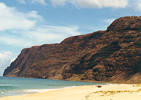 |
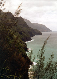
 Two views
of the tall (up to 4000') sea cliffs on Kauai's western Na Pali coast,
which along with the Kalalau Valley (next photo) and the adjacent Alakai
Swamp are the main reasons why you can't circumnavigate Kauai by car. Above
left is the north end of the Na Pali cliffs, from the half-mile marker
on the trail south from the west end of the Kuhio Highway to the Kalalau
Valley. Above right is the south end of the cliffs, from isolated,
barren Polihale Beach in southwest Kauai, near the west end of Kaumualii
Highway (state route 50). (Both photos September 1999) Two views
of the tall (up to 4000') sea cliffs on Kauai's western Na Pali coast,
which along with the Kalalau Valley (next photo) and the adjacent Alakai
Swamp are the main reasons why you can't circumnavigate Kauai by car. Above
left is the north end of the Na Pali cliffs, from the half-mile marker
on the trail south from the west end of the Kuhio Highway to the Kalalau
Valley. Above right is the south end of the cliffs, from isolated,
barren Polihale Beach in southwest Kauai, near the west end of Kaumualii
Highway (state route 50). (Both photos September 1999)
See also the FAQs item on the
history of the abortive attempt to connect what are now state routes 550
and 560, to provide a direct road link between northwestern and southwestern
Kauai.
|
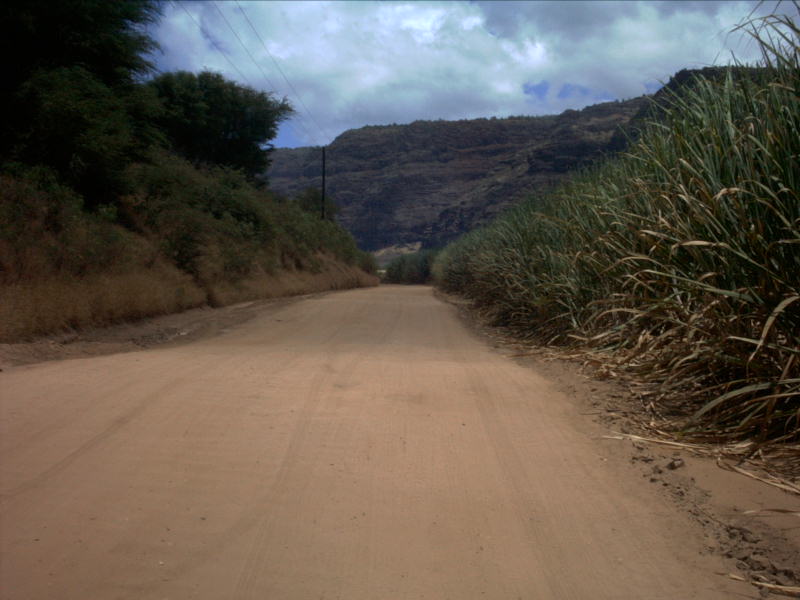
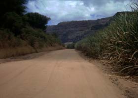
 This unpaved road takes
you from the west end of the Kaumualii Highway (state route 50) to Polihale
Beach, shown above. (August 2003, photo courtesy of Barry Morris, D.C.) This unpaved road takes
you from the west end of the Kaumualii Highway (state route 50) to Polihale
Beach, shown above. (August 2003, photo courtesy of Barry Morris, D.C.)
|
|
|
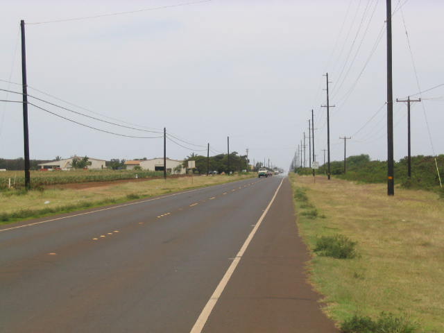
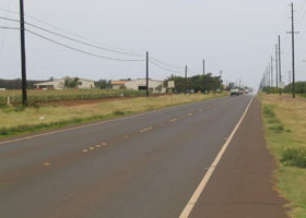
 A straightaway on the Kaumualii Highway in southwest Kauai near mile 30, approaching the junction with Tartar Drive to the National Bureau of Standards' WWVH radio station for broadcasting time signals. (May 2003, photo courtesy of Craig Seufert) A straightaway on the Kaumualii Highway in southwest Kauai near mile 30, approaching the junction with Tartar Drive to the National Bureau of Standards' WWVH radio station for broadcasting time signals. (May 2003, photo courtesy of Craig Seufert)
|
 |
 |
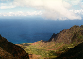
| The 4000'
deep Kalalau Valley creates a break in the Na Pali cliffs, as viewed from
an overlook at the end of Kokee Road (continuation of state route 550,
which technically ends a few miles to the south at the entrance to Kokee
State Park). (September 1999) |
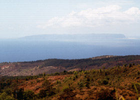
Off in the
distance, from another nearby overlook, the "forbidden island" of Niihau,
a privately-owned island that generally puts out the unwelcome mat for
visitors. Niihau is basically one big ranch, worked by a mainly native
Hawaiian population. The owners seek to preserve Niihau as a last outpost
of native Hawaiian culture (native Hawaiians are a minority most everywhere
else in Hawaii). (September 1999)
|
|
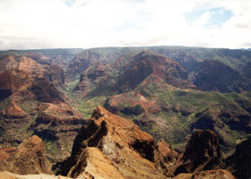
Waimea Canyon, "the
Grand Canyon of the Pacific," which runs along the east side of Kokee Road
(in this area, state route 550). (September 1999)
|
 |
 |
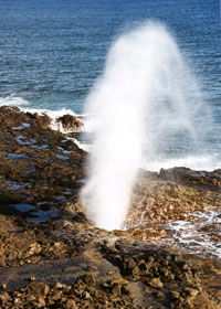
One of the
best of Hawaii's blowholes in action, Spouting Horn on Kauai's south shore
off Lawai Road, which runs west from the south end of Poipu Road (part
of county route 520). A few seconds after waves crash against the shore,
some of the water squirts out of a hole the waves have eroded through the
rock. (September 1999)
|
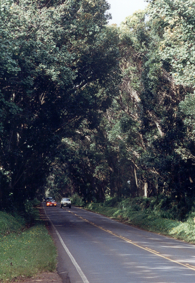
The return
trip from Kauai's south shore usually takes you through the 0.7 mile long
Koloa Tree Tunnel, here viewed from its north end near where Maluhia Road
(part of county route 520) joins the Kaumualii Highway (state route 50). The canopy was still
recovering from hurricane damage, and so a little more ragged on the top than it used to be. (November 2001)
|

|
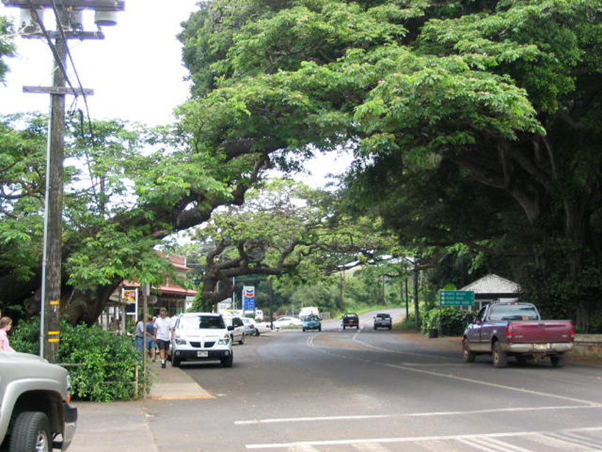
South of the tree tunnel,
through Koloa town, county route 520 briefly heads west under another tree canopy on Koloa
Road, before turning back south on Poipu Road at the Chevron station shown in the background. Koloa Road continues west as county route 530 past the gas station. (May 2003, photo courtesy of Craig Seufert)
|
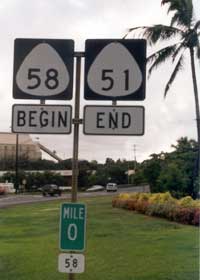
On the east side of
Lihue, the roadway for Waapa Road (part of state route 51) continues with
both a name and number change, to Nawiliwili Road (state route 58).
Kauai is the only Hawaii island where I've seen this kind of begin/end
sign combination. The zero milepost for route 58 confirms the route
number change. (November 2001) |
|
 |
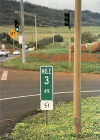 |
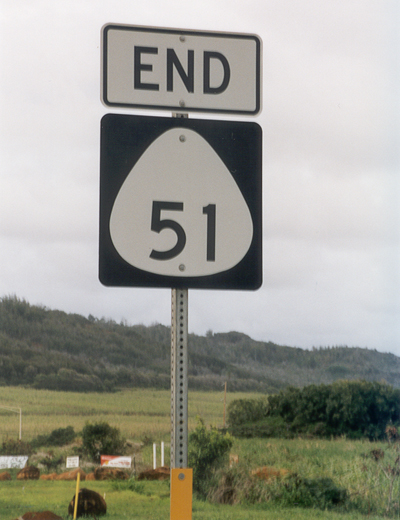
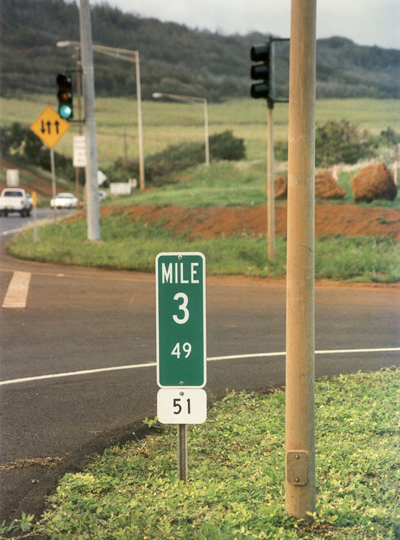
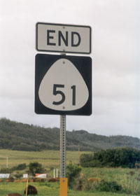
The north
end of state route 51, where the Kapule Highway joins the Kuhio Highway
(state route 56), is marked by an "end 51" sign (above left), followed
by route 51's terminal milepost showing the exact total length of 3.49
miles (above right). (Both photos November 2001)
|
 |
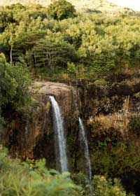 |
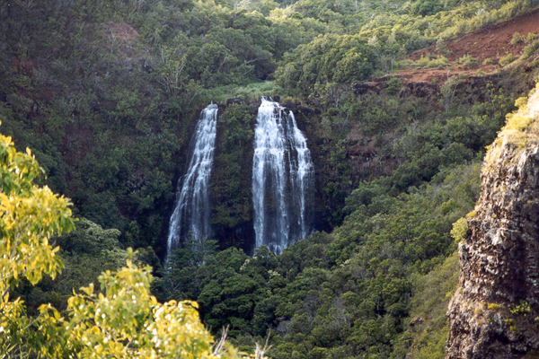
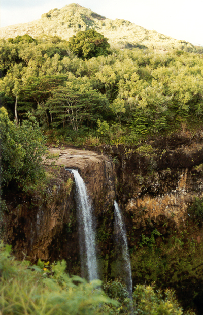
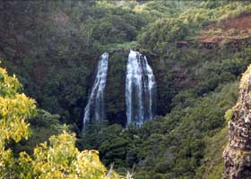
The highways
leading into the hills northwest of Lihue take you to some spectacular
waterfalls, such as 'Opaeka'a Falls north of Kuamoo Road (state route 580)
from an overlook near mile 3 (above left), and Wailua Falls off the short
loop at the end of Maalo Road (state route 583) (above right). (Both photos
September 1999)
|
Go to the previous or next parts of the Hawaii Highways road photos collection:
or directly to other parts:
Overview · Introduction · Interstate H-3 · Interstate
H-1 · Other Freeways
Other Oahu South · Other
Oahu West · Other Oahu East · Piilani Highway
Kahekili Highway · Other
Maui · Lanai/Molokai · Kalawao County
Saddle Road · Observatories Roads · Lava Closures · Red Road
Waipio Valley · Other Big Island
or to other sections of the Hawaii Highways site:
Comments, etc.? Please e-mail me.
© 1999-2004 Oscar Voss. |