| Hawaii Highways road photos --
Other Freeways
(Oahu part 3 of 6 -- other Oahu
parts: Interstate H-3 ·
Interstate
H-1 ·
Other
Oahu South · Other
Oahu West · Other
Oahu East)
This page has more than a dozen photos of Oahu's other freeways, Interstate H-2 from Pearl City to Wahiawa, and the Moanalua Freeway (most is Interstate H-201, but the entire freeway was originally signed only as state route 78) from Aiea to Honolulu. This page includes several photos of the new Interstate route signs on the Moanalua Freeway, installed in July 2004.
NOTE: In case you want more detail, you can click most of
the photos below (generally those from my 2001 and 2005 trips) to view an enlarged,
higher-quality (less .jpg compression) version. Those alternate versions
have larger file sizes, so please be patient while they download.
Interstate H-2
(recently named the Veterans Memorial Freeway) |
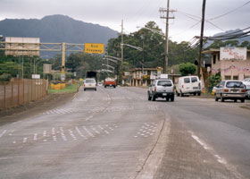 |
 The exact
north end of Interstate H-2 is just before the yellow "end freeway" overhead
sign, and driveways for some of the shops serving soldiers at the adjacent
Schofield Barracks Army base. The on-ramp from the right carries traffic
from the Kamehameha Highway (part of state route 99 south of H-2, state
route 80 to the north). This highway continues beyond the "end freeway"
sign as Wilikina Drive (also part of state route 99). (November 2001) The exact
north end of Interstate H-2 is just before the yellow "end freeway" overhead
sign, and driveways for some of the shops serving soldiers at the adjacent
Schofield Barracks Army base. The on-ramp from the right carries traffic
from the Kamehameha Highway (part of state route 99 south of H-2, state
route 80 to the north). This highway continues beyond the "end freeway"
sign as Wilikina Drive (also part of state route 99). (November 2001)
|
·
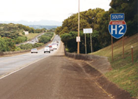
 While Interstate H-3
is definitely the most scenic Interstate in Hawaii,
H-2 is also rather scenic, viewed here southbound near the freeway's
north end. (May 2000) While Interstate H-3
is definitely the most scenic Interstate in Hawaii,
H-2 is also rather scenic, viewed here southbound near the freeway's
north end. (May 2000) |
|
|
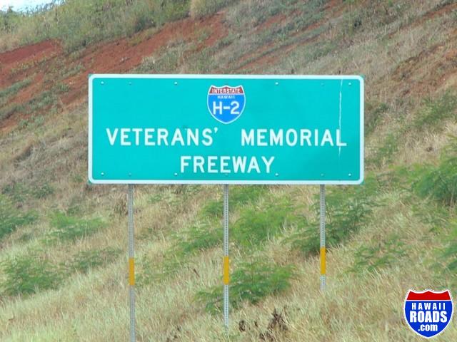
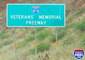
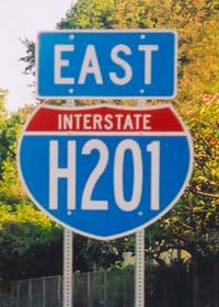
Most of Hawaii's Interstates were assigned only route numbers, and not route names (like all of Hawaii's other highways), until 2002. Signs like this one, on northbound H-2 near its south end, posting the new names include a hyphenated Interstate shield with the state name. (October 2004, courtesy of Ryan Ozawa)
|
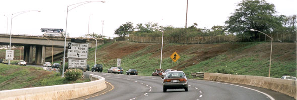 |
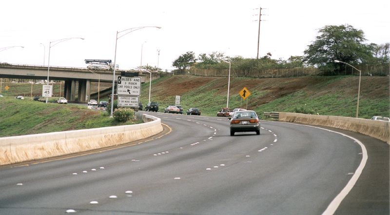
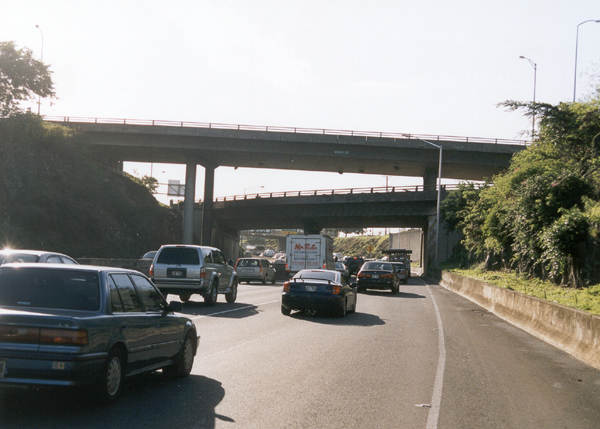
 H-2's south
end is at this left entrance onto eastbound Interstate H-1. The white sign
on the left indicates a left exit from the end of H-2 to H-1's "zipper
lane" (eastbound- and morning rush-only, HOV movable-barrier-separated
express lane, created from two westbound lanes). (November 2001) H-2's south
end is at this left entrance onto eastbound Interstate H-1. The white sign
on the left indicates a left exit from the end of H-2 to H-1's "zipper
lane" (eastbound- and morning rush-only, HOV movable-barrier-separated
express lane, created from two westbound lanes). (November 2001) |
Moanalua Freeway (Interstate H-201/state route
78) |
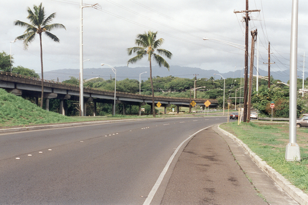
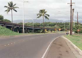
The west end of the
Moanalua Freeway (here designated solely as state route 78), where its
westbound lanes merge into the Kamehameha Highway (state route 99) northbound.
(November 2001) |
|
 |
The exact
western end of Interstate H-201 is just ahead (west) of the bridge over Interstate H-1 on which I was standing, where the entrance ramp on the left from H-1 exit 13B merges with the through eastbound lanes. The Moanalua Freeway continues from this point about ¾ mile, designated as well as signed as state route 78, to the interchange with the Kamehameha Highway (state route 99) shown above. (November 2001)
|
|
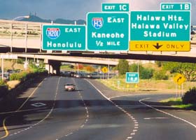
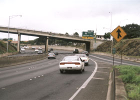
Beginning in July 2004, Hawaii DOT started adding Interstate shields to the Interstate-designated part of the Moanalua Freeway, about a decade and a half after that segment was added to the Interstate system. The "bubble" shape of the Interstate shield blank, and the skinny characters, helped squeeze the four-character route number onto the shield, though at the expense of legibility. This photo was taken on the eastbound freeway, near H-201's west end, just before the overpass for the long ramp directly connecting westbound Interstate H-3 with westbound Interstate H-1, and just after the HOV lane begins on the left side of the roadway. (May 2005)
|
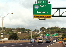
The eastbound junction with Interstate H-3 eastbound. H-3 was built with sophisticated computerized traffic management systems, including the electronic display on this exit sign. (May 2000) |
|
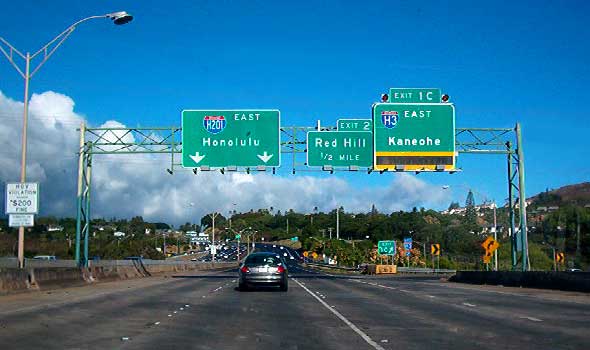 |
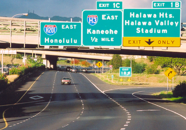
This set of overhead signs, right at the eastbound Interstate H-3 exit, includes the new Interstate H-201 signage. Also shown, at far left, is a small sign warning of penalties for violators of HOV restrictions on the left lane. (July 2004, photo courtesy of Brian Galapin)
|
A freestanding H-201 reassurance shield, along the eastbound freeway just west of exit 3. (May 2005) |
|
 |
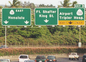 |
Approaching exit 3 eastbound, the overhead signs show how H-201 used to be signed only as a state route, and also include one of the few references on an overhead to one of Hawaii's minor 4-digit routes. (Oddly enough, the overhead is the only visible evidence of the numbering for the road between the airport and the hospital. There are no route shields, or even mileposts, on that road, except some stray markers at its southern end indicating its former designation as state route 66.) (Both photos May 2000)
|
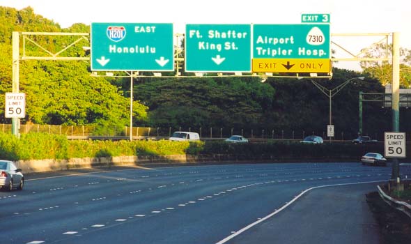 |
The new version of the above overhead sign assembly, showing the Interstate route shield replacing the old state route 78 signage, as well as the low 50 mph speed limit for most of the freeway. (May 2005)
|
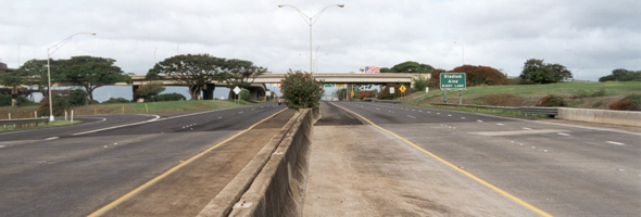
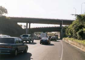
H-201 and the Moanalua
Freeway merge at their east end into Interstate H-1, at the Kahauiki Interchange, viewed here from the eastbound H-201/Moanalua Freeway shoulder. The middle level of this interchange is westbound H-1; the upper level is the Middle Street overpass. (November 2001) |
|
  |
| Within the
Kahauiki Interchange, the eastbound H-201/Moanalua Freeway lanes (three
lanes on the left) merge with H-1 eastbound (two lanes on the right) as
H-1's eastbound lanes emerge from the Middle Street Tunnel, in the photo
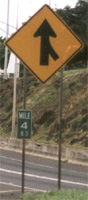
above left. Above right, a terminal milepost, mounted under the merge sign
(reflecting the total mileage for the Moanalua Freeway, including the non-Interstate portion), marks the formal end of H-201. (Both photos November 2001) |
Ryan Ozawa's new HawaiiRoads.com site has lots of additional H-2 photos.
Go to the previous or next parts of the Hawaii Highways road photos collection:
or directly to other parts:
Overview ·
Introduction · Interstate H-3 · Other Oahu West · Other
Oahu East
Kuhio Highway · Other Kauai · Hana
Highway · Piilani Highway
Kahekili Highway · Other Maui · Lanai/Molokai · Kalawao
County
Saddle Road · Observatories Roads · Lava Closures · Red Road
Waipio Valley · Other
Big Island
or to other sections of the Hawaii Highways site:
Comments, etc.? Please e-mail me.
© 1999-2006 Oscar Voss. |