| Hawaii Highways road photos --
Other Oahu East
(Oahu page 6 of 6 -- other Oahu
pages: Interstate H-3 ·
Interstate
H-1 ·
Other
Freeways · Other
Oahu South · Other
Oahu West)
The following 13 photos complete this collection's
coverage of non-freeway highways on Oahu. Most of the photos are from roads
between Honolulu and the northeast "windward" coast of Oahu. The
remaining photos cover the windward coast, plus the north coast down to
Haleiwa in north central Oahu.
NOTE: In case you want more detail, you can click many of
the photos below (for now, most of the 2001 photos, plus the 1960 Pali Highway photo) to view an enlarged,
higher-quality (less .jpg compression) version. Those alternate versions
have larger file sizes, so please be patient while they download.
 |
 |
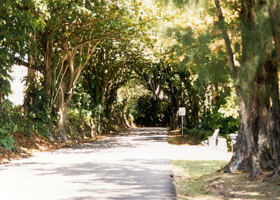
 A "tunnel
of trees" on Nuunau Pali Drive, a short scenic drive off the Pali Highway
(state route 61) running northeast of Honolulu to Oahu's windward (northeast)
coast. (September 1999) A "tunnel
of trees" on Nuunau Pali Drive, a short scenic drive off the Pali Highway
(state route 61) running northeast of Honolulu to Oahu's windward (northeast)
coast. (September 1999) |
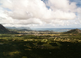
Kaneohe Bay on the windward
coast, from the Nuunau Pali overlook off the Pali Highway. Since this is
one of the few openings through the Koolau Range for the trade winds to
blow through, it is usually very windy here. This is also where
the forces of Kamehameha the Great fought their final battle to conquer
all the Hawaiian islands, cornering the Oahu army here and then pushing
the survivors off the high cliff. (September 1999)
|
 |
 |
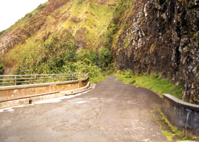
A portion
of the Pali Trail, running down from the Nuuanu Pali gap in the Koolau
Range (now closed to motor vehicles, but can be traveled by bicycle or on foot).
This is the first road that crossed the mountains to connect Honolulu to
Oahu's windward coast. The workers constructing the Trail reportedly came across the
skeletal remains of the ill-fated Oahu warriors. (September 1999)
|
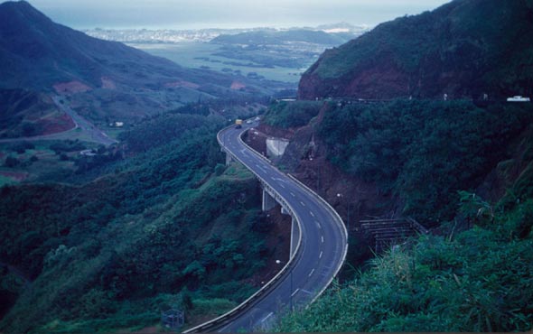
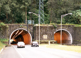
Also from
the Nuuanu Pali overlook, the east portal of the Pali Tunnels on route
61, the divided highway that replaced the Pali Trail circa 1960. (September
1999) |
 |
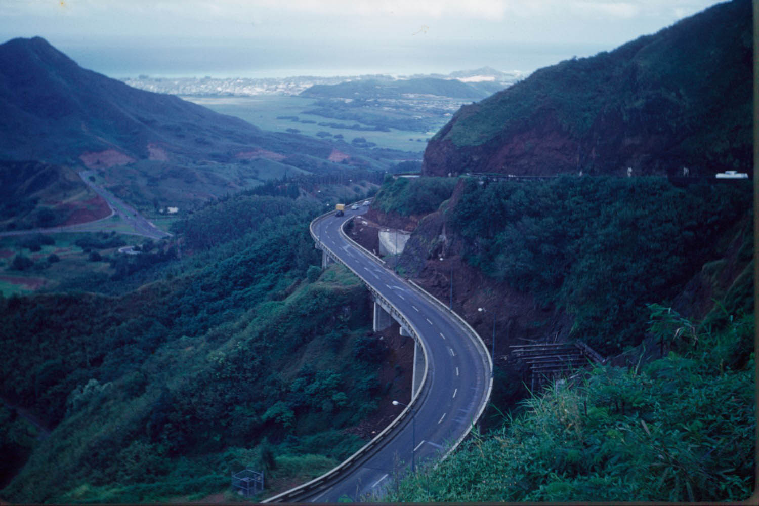
The Pali
Highway approaching the Pali Tunnels from the northeast, in 1960 soon after
the tunnels were completed but before work was finished on the approach
roads. Eastbound traffic away from the tunnels toward Kailua (see the big
white car with tailfins at the far right edge of the photo) was still using
a part of the old Pali Trail. The new
viaduct (center) carried traffic to the tunnels and from there to downtown
Honolulu; work was still in progress on the new roadway to the right of
the viaduct that later replaced the old eastbound lanes. Downhill and to
the left is the improved Pali Highway at the junction with Kamehameha Highway
(route 83). (Photo by T.R. Smith, courtesy of his son Ken Smith)
|
 |
 |
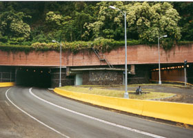
The west
and east portals (respectively) of the Pali Tunnels on route 61. (Both September 1999)
|
 |
 |
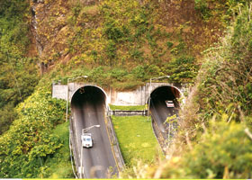
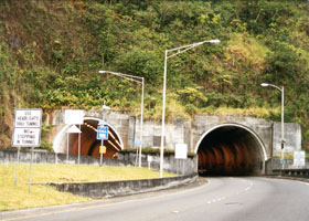
| The west
and east portals (respectively) of the Wilson Tunnels on the Likelike Highway
(state route 63), which was completed shortly after the Pali Highway as
a second divided highway to the windward coast from Honolulu. Before Interstate
H-3 was built, routes 61 and 63 were the only highways through the mountains
between Honolulu and the windward coast. (Both photos September 1999)
By the way, "Likelike" is pronounced "leak-eh-leak-eh," rather than
"like-like." The highway was named after Princess Miriam Likelike, younger
sister of Hawaii's last two monarchs, King David Kalakaua and Queen Lydia
Liliuokalani.
|
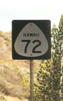
 A rare
style of state route shield with the state name added, on the Kalanianaole
Highway (state route 72) south of Kailua. (September 1999) A rare
style of state route shield with the state name added, on the Kalanianaole
Highway (state route 72) south of Kailua. (September 1999) |
|
|
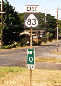
 A standard Hawaii
state highway route marker, with a standard mile marker (with route number),
at the south end of old state route 83 (part of the Kamehameha Highway)
in Haleiwa on Oahu's north shore, where it joins state routes 99 and 930.
This stretch was recently bypassed by another two-lane road, which now
carries the route 83 designation, but the sign assembly shown here was
still there on the old route in May 2005. (September 1999) A standard Hawaii
state highway route marker, with a standard mile marker (with route number),
at the south end of old state route 83 (part of the Kamehameha Highway)
in Haleiwa on Oahu's north shore, where it joins state routes 99 and 930.
This stretch was recently bypassed by another two-lane road, which now
carries the route 83 designation, but the sign assembly shown here was
still there on the old route in May 2005. (September 1999) |
 |
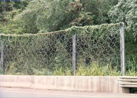 |
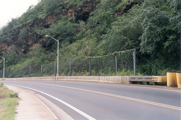
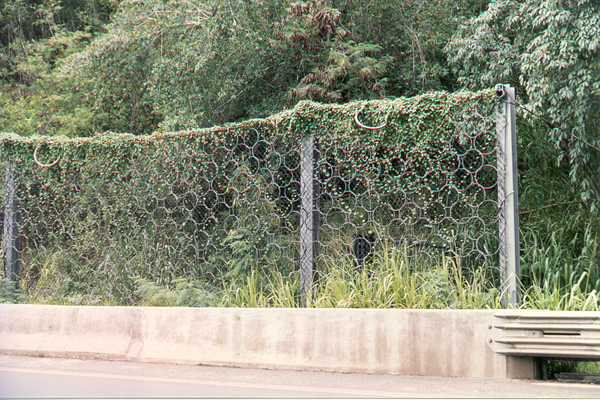
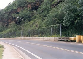
Two views
of a rockfall fence built along the Kamehameha Highway (state route 83)
along Waimea Bay. The rockfalls here in early 2000 were a huge headache
for Hawaii DOT. They closed the highway for a time, requiring long
detours for north shore residents since this is the only passable through
road along the north shore. Hawaii DOT initially built a temporary road
away from the cliff on the adjacent beach, but it kept getting washed out.
Because the highway and the cliff were so close to the ocean, and the waves
are strong in the winter, there wasn't much room to move the highway away
from the cliff. Cutting back the cliff away from the highway wasn't
an option either, due to burial caves in the cliff face and the remnants
of a heiau (Hawaiian temple) on top. So Hawaii DOT wound up moving
the highway a little father away from the cliff and closer to the ocean,
and building a strong fence to try to keep rocks off the road. (Both photos
November 2001)
|
Go to the previous or next parts of the Hawaii Highways road photos collection:
or directly to other parts:
Overview · Introduction · Interstate H-3 · Interstate
H-1 · Other Freeways
Other Oahu South · Other
Kauai · Hana Highway · Piilani Highway
Kahekili Highway · Other
Maui · Lanai/Molokai · Kalawao County
Saddle Road · Observatories Roads · Lava Closures · Red Road
Waipio Valley · Other
Big Island
or to other sections of the Hawaii Highways site:
Comments, etc.? Please e-mail me.
© 1999-2003, 2006 Oscar Voss. |