| Hawaii
Highways road photos -- Piilani Highway (page
2 of 2)
This is page 2 of photos, from my October 1999, May 2000, and November
2001 visits to Maui, of the Piilani Highway through rugged upcountry south
Maui (part of county route 31). Page 1
provides introductory information about the entire highway (including a
map, and warnings about road conditions), plus photos of or from the highway
from its eastern end south of Kipahulu where it meets the Hana
Highway, west to Kaupo. The photos below complete the journey, from
Kaupo to Ulupalakua, where the Piilani Highway meets the Kula Highway (state
route 37). Both pages cover the highway in reverse milemarker order, from
east to west, for continuity with the photo pages for the Hana
Highway, which together with the Piilani Highway form a loop through
east Maui around the Haleakala volcano.
NOTE: In case you want more detail, clicking some of the photos below
(for now, just some from my 2001 trip) will call up enlarged, higher-quality
(less .jpg compression) versions. Those alternate versions have larger
file sizes, so please be patient while they download.

Page 1: introduction, and Kipahulu-Kaupo
|
|
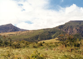
 The Kaupo Gap, viewed
from the Piilani Highway. This is one of the deep valleys eroded into the
Haleakala volcano crater rim (the other one, on the north side of Haleakala,
can be seen from the Hana Highway). (October
1999) The Kaupo Gap, viewed
from the Piilani Highway. This is one of the deep valleys eroded into the
Haleakala volcano crater rim (the other one, on the north side of Haleakala,
can be seen from the Hana Highway). (October
1999)
|
 |
 |
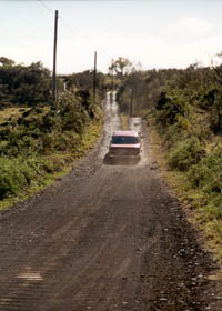
 About four miles of the
Piilani Highway around Kaupo are still unpaved (the county transportation
department would like to change that -- but the stone walls limiting the
road to one lane are likely to stay). It's easy to get stuck on this stretch
after it's rained, so tourists need to check with the national park ranger
station at Oheo Gulch before taking it on. (May 2000) About four miles of the
Piilani Highway around Kaupo are still unpaved (the county transportation
department would like to change that -- but the stone walls limiting the
road to one lane are likely to stay). It's easy to get stuck on this stretch
after it's rained, so tourists need to check with the national park ranger
station at Oheo Gulch before taking it on. (May 2000)
|
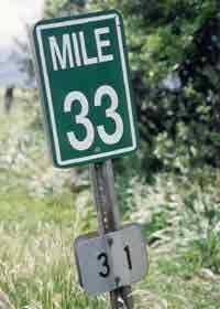
 This is the
milemarker style used on the Piilani Highway, unlike the standard style
used in Hawaii where the mile number is aligned vertically rather than
horizontally. White "31" route number plates under the milemarkers are,
except at the highway's ends, the only indication of the route number.
(November 2001) This is the
milemarker style used on the Piilani Highway, unlike the standard style
used in Hawaii where the mile number is aligned vertically rather than
horizontally. White "31" route number plates under the milemarkers are,
except at the highway's ends, the only indication of the route number.
(November 2001)
|
 |
 |
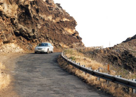
 While the
pavement has resumed by mile 33.4 (this photo was taken at mile 27.7), it is narrow and very roughly patched. The county is gradually
resurfacing the road (see below for the results), but hasn't yet gotten
this far east. As of May 2005, resurfacing had been completed east to
mile 25.5. (May 2000) While the
pavement has resumed by mile 33.4 (this photo was taken at mile 27.7), it is narrow and very roughly patched. The county is gradually
resurfacing the road (see below for the results), but hasn't yet gotten
this far east. As of May 2005, resurfacing had been completed east to
mile 25.5. (May 2000) |
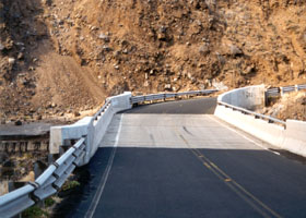
 The Manawainui Bridge, one of the
newest on the Piilani Highway, just west of where the photo to
the left was taken. It was built as a replacement for an old bridge (see
the old alignment just to the left of the new bridge). More of these "freeway-style"
bridges (as some local residents complain) are being built as old bridges
require replacement, with two more bridges like this built as of November
2001. Unlike the Hana Highway, the Piilani Highway west of Kaupo has no
historic designations, and so the county is building new bridges to normal
engineering standards rather than incur the higher costs of preserving
or replicating the old structures. (May 2000) The Manawainui Bridge, one of the
newest on the Piilani Highway, just west of where the photo to
the left was taken. It was built as a replacement for an old bridge (see
the old alignment just to the left of the new bridge). More of these "freeway-style"
bridges (as some local residents complain) are being built as old bridges
require replacement, with two more bridges like this built as of November
2001. Unlike the Hana Highway, the Piilani Highway west of Kaupo has no
historic designations, and so the county is building new bridges to normal
engineering standards rather than incur the higher costs of preserving
or replicating the old structures. (May 2000)
|
 |
 |
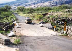
 A culvert
without guardrails, at mile 30.4. A similar culvert east of Kaupo had rudimentary
guardrails installed soon after my 2000 visit, and maybe that has been
done here too since my last visit in May 2005. A culvert
without guardrails, at mile 30.4. A similar culvert east of Kaupo had rudimentary
guardrails installed soon after my 2000 visit, and maybe that has been
done here too since my last visit in May 2005.
|
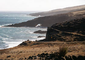
 A sea arch
along the highway west of Kaupo, from mile 28.7. (May 2000) A sea arch
along the highway west of Kaupo, from mile 28.7. (May 2000) |
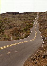
 The Pillani Highway
pavement finally smooths out on the way back to central Maui -- but the
county transportation department simply paved over the existing alignment,
leaving it narrow and crooked. (That's how the residents of upcountry south
Maui seem to like it -- some aren't too wild even about plans to pave the
unpaved stretches like the one shown above, but opposition is more widespread
to any more extensive road improvements.) (October 1999) The Pillani Highway
pavement finally smooths out on the way back to central Maui -- but the
county transportation department simply paved over the existing alignment,
leaving it narrow and crooked. (That's how the residents of upcountry south
Maui seem to like it -- some aren't too wild even about plans to pave the
unpaved stretches like the one shown above, but opposition is more widespread
to any more extensive road improvements.) (October 1999)
|
|
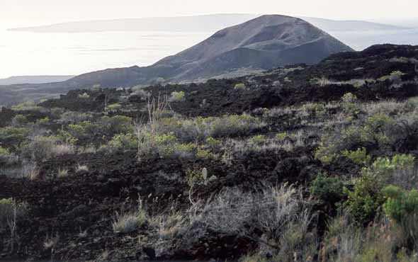 |
 At mile 18.2,
a view of the Pimoe cinder cone, one of several along the southwest rift
zone of the Haleakala volcano (outlet of its most recent eruption, in the
late 18th century), downhill from an old lava field the highway crosses.
The uninhabited island of Kahoolawe is off in the distance, behind Pimoe.
(November 2001) At mile 18.2,
a view of the Pimoe cinder cone, one of several along the southwest rift
zone of the Haleakala volcano (outlet of its most recent eruption, in the
late 18th century), downhill from an old lava field the highway crosses.
The uninhabited island of Kahoolawe is off in the distance, behind Pimoe.
(November 2001)
|
 |
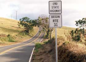 |
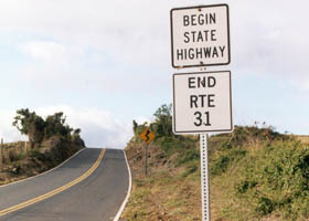
 The end of
the county road, where it meets the Kula Highway (state route 37) to Kula
and beyond in central Maui. These are the only things resembling route
markers on the Piilani Highway, though some of the milemarkers (as shown
above) also indicate the route munber. (Both photos May 2000) The end of
the county road, where it meets the Kula Highway (state route 37) to Kula
and beyond in central Maui. These are the only things resembling route
markers on the Piilani Highway, though some of the milemarkers (as shown
above) also indicate the route munber. (Both photos May 2000) |
Unlike its famous counterpart the Hana Highway, I am
not aware of any other web sites focusing on the Piilani Highway (though
some sites about the Hana Highway, or Maui in general, provide limited
coverage of the Piilani Highway).
Mark Furqueron's
Hawaii road photos page has some Piilani Highway photos.
Also, one mountain biker's site has several
Piilani Highway photos (on two pages -- link is to the first page).
As for books, Richard Sullivan's Driving
and Discovering Hawaii: Maui and Molokai (1998) includes several pages
of photos on the Piilani Highway, following its more extensive coverage
of the Hana Highway. |

Page 1: introduction, and Kipahulu-Kaupo
|
Overview · Introduction
· Interstate H-3 · Interstate H-1 · Other Freeways
Other Oahu South · Other
Oahu West · Other Oahu East · Kuhio Highway
Other Kauai · Other
Maui · Lanai/Molokai · Kalawao County
Saddle Road · Observatories Roads · Lava Closures · Red Road
Waipio Valley · Other
Big Island
or to other sections of the Hawaii Highways site:
Comments, etc.? Please e-mail
me.
© 1999-2003, 2006-2008 Oscar Voss. |


