| Hawaii
Highways road photos -- Introduction (page
2 of 2)
This is the second page of a introductory primer on the
standard (and some of the non-standard) route markers and other road signs
of Hawaii, and other roadside features found on all the islands.
The photos on page 1 focused on route
signs and milemarkers. The photos below cover other kinds of signs,
pavement markings, and other road features, and also contains links to
the rest of the Hawaii Highways road photos pages.
NOTE: In case you want more detail, clicking a few of the
photos below will call up enlarged, higher-quality (less .jpg compression)
versions. Those alternate versions have larger file sizes, so please be
patient while they download. |

Page 1: non-Interstate route shields, milemarkers, etc.
|
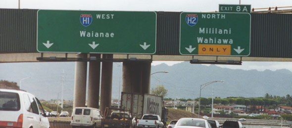 |
  Standard route shields for the three main Interstate routes in Hawaii (all on Oahu). Hawaii's Interstate route numbers officially include a hyphen after the "H," but most shields posted on the freeways omit the hyphen (see below for some exceptions). (October and September 1999, respectively) Standard route shields for the three main Interstate routes in Hawaii (all on Oahu). Hawaii's Interstate route numbers officially include a hyphen after the "H," but most shields posted on the freeways omit the hyphen (see below for some exceptions). (October and September 1999, respectively) |
|
 |
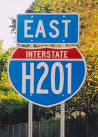
 Beginning in July 2004, Hawaii DOT started adding Interstate shields to the Moanalua Freeway, between H-1 exits 13 and 19, about a decade and a half after that segment was added to the Interstate system as Interstate H-201. The "bubble" shape of the Interstate shield blank, and the skinny characters, helped squeeze the four-character route number onto the shield, though at the expense of legibility. These photos were both taken just west of exit 3 on the eastbound freeway. (Both photos May 2005) Beginning in July 2004, Hawaii DOT started adding Interstate shields to the Moanalua Freeway, between H-1 exits 13 and 19, about a decade and a half after that segment was added to the Interstate system as Interstate H-201. The "bubble" shape of the Interstate shield blank, and the skinny characters, helped squeeze the four-character route number onto the shield, though at the expense of legibility. These photos were both taken just west of exit 3 on the eastbound freeway. (Both photos May 2005)
|
|
|
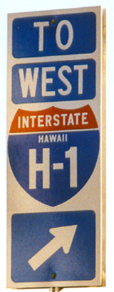
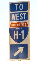
 Some of the signs currently on local streets directing traffic to the Interstates look like this, with hyphenated route numbers, and including the state name (as if it were ever necessary to remind people that they're in Hawaii!). Others look like the on-freeway shields shown above. (September 1999) Some of the signs currently on local streets directing traffic to the Interstates look like this, with hyphenated route numbers, and including the state name (as if it were ever necessary to remind people that they're in Hawaii!). Others look like the on-freeway shields shown above. (September 1999)
|
|
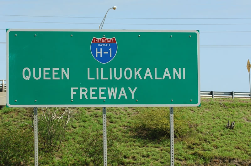
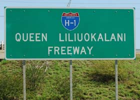
Most of Hawaii's Interstates were assigned only route numbers, and not route names (like all of Hawaii's other highways), until 2002. New signs like this (on eastbound H-1 at its west end) posting the new names include a hyphenated Interstate shield with the state name, but in a different style than shown above on local streets directing motorists to freeway entrances. These now are the only on-freeway Interstate shields with the state name, or with hyphenated route numbers. (February 2006, courtesy of Jeff Royston/AARoads.com)
|
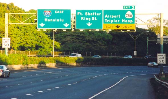
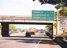
Hawaii's Interstates have overhead signs, similar to those used in California, to give motorists advance notice of the next three exits. This sign is on westbound Interstate H-1 through downtown Honolulu at the Aala Street underpass, along with a low-clearance sign, and a 50mph maximum/40mph minimum speed limit sign typical on this older stretch of downtown freeway. (May 2005)
|
|
|
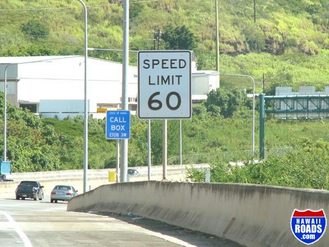
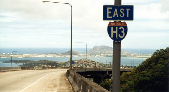
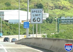
Hawaii was the last of the 50 states to hang on to the speed limit imposed by the old 55 mph National Maximum Speed Limit. In 2002, Hawaii DOT lightened up a little (a byproduct of public outcry over a short-lived photo speed enforcement program), posting a few stretches of freeway at 60 mph (none yet at 65 mph or higher), like this stretch of H-3 entering the Halawa Valley northeast toward the Koolau Range. (October 2004, courtesy of Ryan Ozawa)
|
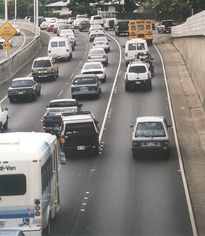
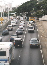
This stretch
of Interstate H-1 westbound through downtown Honolulu, from the Punahou
overpass, displays typical pavement markings on Hawaii roads. There is
extensive use of raised reflectors as supplemental lane markings, similar
to California's old "Botts Dots" (it helps that only one or two ultra-high-altitude
roads on the Big Island ever need snowplowing). On freeways, Hawaii DOT
uses solid lines between lanes to keep motorists from moving from the left
lanes into the right lane, where other traffic is about to enter it from
the other side at a freeway entrance. (November 2001)
|
|
 |
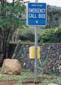 |
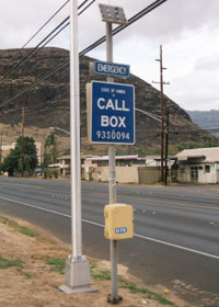
Hawaii has
emergency call boxes scattered along its Interstates and some other major
routes. The call box signs resemble those in California. The main
difference is that while California's specify the county where the call
box is located, Hawaii's instead show who maintains the call box ("State
of Hawaii" if it's Hawaii DOT, as with the sign above left along state
route 93 on Oahu, or "County of ___" for county-maintained boxes, as with
the sign above right near the west end of state route 340 in northwest
Maui). County-maintained call boxes also lack the code at the bottom indicating
their location by route, traffic direction, and mile (times 10). (Both
photos November 2001)
|
|
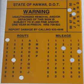
Hawaii DOT places on the back of some of its signs stickers like this one, to indicate exactly where the sign belongs, and when it was erected (in this case, on state route 160 on the Big Island, at mile 3.64, in April 1999). (January 2005, courtesy of Tim Reichard)
|
 |
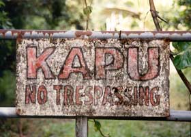 |
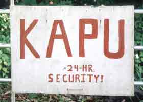
"Kapu" is Hawaiian for "forbidden." On a roadside sign, it means "no trespassing." (Both photos November 2001)
|
 |
 |
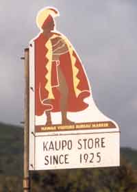
Hawaii Visitor Bureau signs like this highlight both major and minor places of interest along both state and county highways, as with this sign along an unpaved stretch of county route 31 south of the Haleakala volcano on Maui. (November 2001)
|
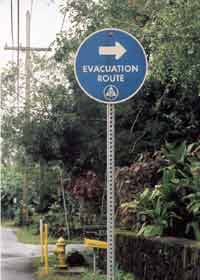
These "evacuation
route" signs are particularly common in areas prone to tsunamis ("tidal
waves"), as here near the Hilo waterfront. (November 2001) |
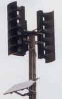 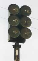 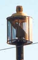 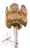 |
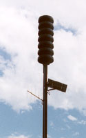
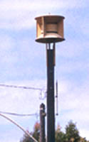
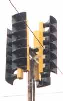
| Civil defense sirens of various types are particularly noticeable along the coasts of all the islands, for tsunami warnings, but are also a common sight along inland highways, particularly on the Big Island with its volcano and earthquake hazards. |
    |
Page 1: route shields and milemarkers
|
or go to the previous or next parts of the Hawaii Highways road photos collection:
or directly to other parts:
Interstate H-1 · Other Freeways · Other Oahu South · Other Oahu West
Other Oahu East · Kuhio Highway
· Other Kauai · Hana Highway
Piilani Highway · Kahekili Highway · Other Maui · Lanai/Molokai
Kalawao County · Saddle
Road · Observatories Roads · Lava Closures
Red Road · Waipio
Valley · Other Big Island
or to other sections of the Hawaii Highways site: |
 |
Comments, etc.? Please e-mail me.
© 1999-2006 Oscar Voss. |