| Hawaii
Highways road photos -- Interstate H-1 (page 2 of 2)
This is the second photos page for Interstate H-1.
Page
1 covers the Queen Liliuokalani Freeway segment of H-1 west of exit
19. The photos below cover the rest of H-1, the Lunalilo Freeway from the
Kahauiki Interchange (exit 19) to the east end of H-1 just past exit
27.
NOTE: In case you want more detail, you can click many of
the photos below (for now, mainly some of the 2001 photos) to view an enlarged,
higher-quality (less .jpg compression) version. Those alternate versions
have larger file sizes, so please be patient while they download.

Page 1: Queen Liliuokalani Freeway (H-1 west of exit 19)
|
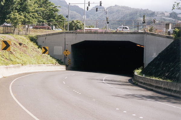
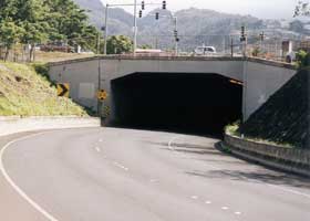
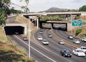
 H-1 eastbound, approaching
the Kahauiki Interchange (exit 19). Only the eastbound lanes pass through
the short (393 feet) Middle Street Tunnel. Both Middle Street and North
King Street pass over the tunnel. (November 2001) H-1 eastbound, approaching
the Kahauiki Interchange (exit 19). Only the eastbound lanes pass through
the short (393 feet) Middle Street Tunnel. Both Middle Street and North
King Street pass over the tunnel. (November 2001)
|
|
 |
 |
 From the
Ola Lane overpass, two different views of the Kahauiki Interchange facing
westbound. Above left, H-1's two eastbound lanes emerge from the Middle
Street Tunnel on the left, to join the three eastbound lanes of the Moanalua
Freeway (now Interstate H-201). The upper bridge crossing the interchange carries Middle Street over the freeways; underneath is the overpass for H-1's two westbound lanes. Above right is another view of H-1 westbound crossing over the Moanalua Freeway and under Middle Street. The speed limit on H-1 through the interchange is only 35 mph.
(November 2001) From the
Ola Lane overpass, two different views of the Kahauiki Interchange facing
westbound. Above left, H-1's two eastbound lanes emerge from the Middle
Street Tunnel on the left, to join the three eastbound lanes of the Moanalua
Freeway (now Interstate H-201). The upper bridge crossing the interchange carries Middle Street over the freeways; underneath is the overpass for H-1's two westbound lanes. Above right is another view of H-1 westbound crossing over the Moanalua Freeway and under Middle Street. The speed limit on H-1 through the interchange is only 35 mph.
(November 2001)
(For photos of the Kahauiki Interchange from the Moanalua Freeway
approaching from the west, see the Other Freeways photos page.)
|
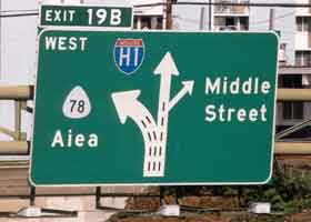 |
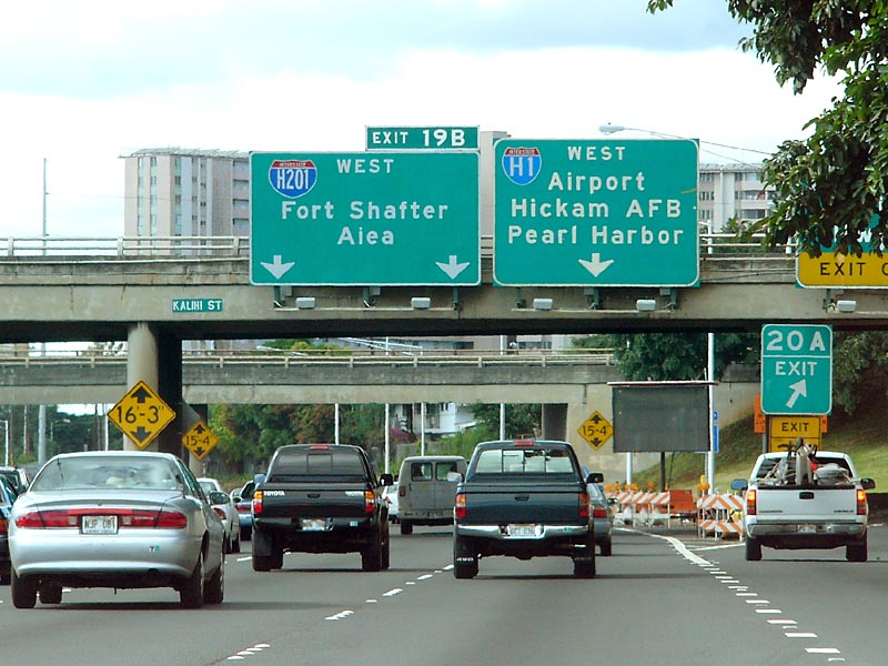
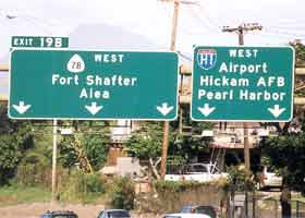
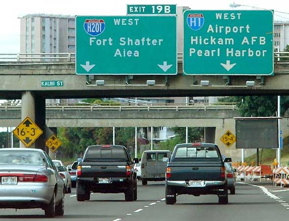
  These three photos of overhead sign assemblies, on westbound H-1 approaching the Kahauiki Interchange with Interstate H-201, illustrate the interchange's confusing westbound traffic pattern, where traffic must take a right exit to stay on H-1. The photo above left was taken atop playground equipment (the kids were quite amused!) at Kalihi Waena Park along the eastbound side of H-1, while H-201 was still signed as state route 78. The center left photo is of a sign assembly near the interchange, taken from the Gulick Avenue overpass. The photo below is of a third sign assembly just after the Likelike Highway exit, with the new Interstate H-201 signage, taken from H-1 by Ryan Ozawa. (Photos November 2001, November 2001, and February 2005 respectively) These three photos of overhead sign assemblies, on westbound H-1 approaching the Kahauiki Interchange with Interstate H-201, illustrate the interchange's confusing westbound traffic pattern, where traffic must take a right exit to stay on H-1. The photo above left was taken atop playground equipment (the kids were quite amused!) at Kalihi Waena Park along the eastbound side of H-1, while H-201 was still signed as state route 78. The center left photo is of a sign assembly near the interchange, taken from the Gulick Avenue overpass. The photo below is of a third sign assembly just after the Likelike Highway exit, with the new Interstate H-201 signage, taken from H-1 by Ryan Ozawa. (Photos November 2001, November 2001, and February 2005 respectively)
|
 |
|
 |
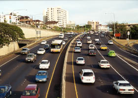 |
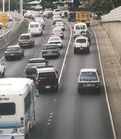
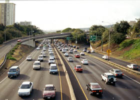
Looking west
and east, respectively, from the Queen Emma Street overpass across H-1
in downtown Honolulu, in the early afternoon. Congestion is common in both
directions, most of the day, on this older stretch of freeway (parts of
which predate statehood) with little room for widening, and no good place
to build a parallel route since Honolulu is completely built out between
the ocean and the mountains. (Both photos May 2000)
|
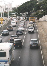
This stretch
of Interstate H-1 westbound through downtown Honolulu, from the Punahou
Avenue overpass, displays typical pavement markings on Hawaii roads. There
is extensive use of raised reflectors as supplemental lane markings, similar
to California's old "Botts Dots" (it helps that only one or two ultra-high-altitude roads on the Big Island ever need snowplowing). On freeways, Hawaii DOT uses solid lines between lanes to keep motorists from moving from the left lanes into the right lane, where other traffic is about to enter it from
the other side at a freeway entrance. (November 2001)
|
|
|
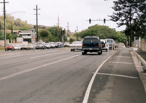
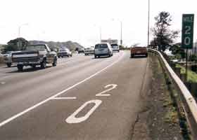
In many places along
H-1 and other freeways on Oahu, such as here on H-1 through downtown Honolulu, milemarker signs are supplemented by painted pavement milemarkers. (November 2001)
|
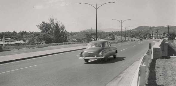 |
Interstate H-1 started off as the Mauka Arterial (Hawaii's first freeway), before it was added to the Interstate system after Hawaii's admission to statehood in 1959. This photo is of the first mile-long segment of the Mauka Arterial, soon after it was opened in November 1953. Shown above are the westbound lanes, at the University Avenue overpass. (1953 or 1954, Bureau of Public Roads, U.S. Department of Commerce; located in archived BPR records, project file U-59(3), box 151, records group 30; courtesy of the National Archives and Records Administration - Pacific Region, San Francisco)
|
 |
 |
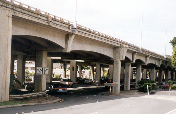
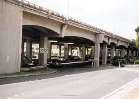
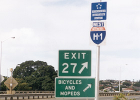
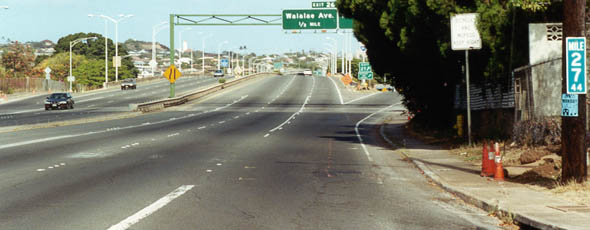
West of exit
27, this H-1 viaduct carries the freeway for about a half-mile over Waialae
Avenue, which begins here and continues west after emerging from under
the viaduct's west end. (November 2001)
|
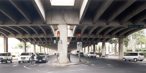
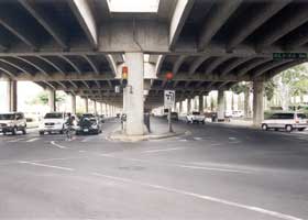
A view of
that viaduct from underneath, at the intersection of Waialae Avenue with
cross-street Kilauea Avenue. (November 2001)
|
The last two ground-level hyphenated Interstate route shields on Interstate H-1 were like this nonstandard version at the Kilauea Avenue exit on westbound H-1 (a similar one preceded the following exit, for Waialae Avenue). Both were replaced by standard unhyphenated shields by my return to Oahu in May 2005. (November 2001)
|
|
 |
 |
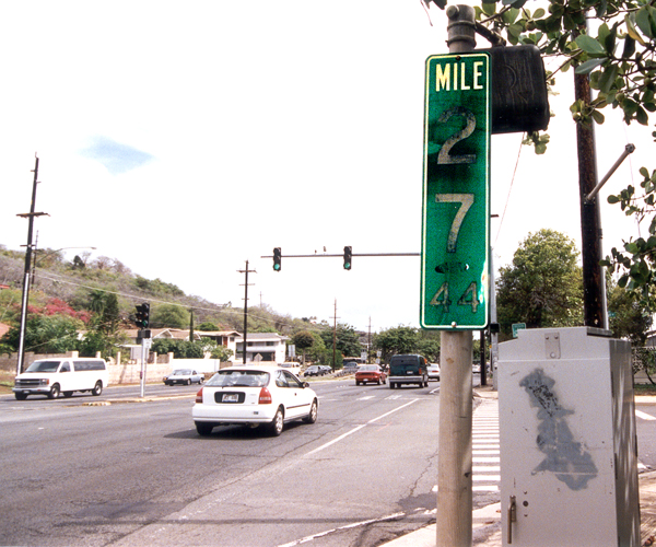
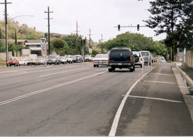
The two photos
above, facing eastbound, show the east end of H-1 in Honolulu northeast
of Diamond Head, at the intersection with Ainakoa Avenue. The highway continues beyond the intersection as the Kalanianaole Highway (state route 72). The formal end of H-1 is marked by the faded terminal milepost in the photo on the right, with a horizontal "44" under the vertical "27" (barely visible, even with digitally enhanced contrast for the very faded milemarker in this photo) to indicate that the route ends at mile 27.44 (about a quarter-mile longer than the actual route mileage). (Both photos November 2001)
|
 |
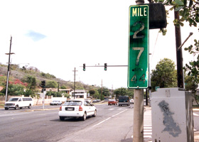
| H-1's
east end, viewed from the east where Kalanianaole Highway (state route
72) ends at Ainakoa Avenue. Exit 27, to Waialae Avenue and Kilauea Avenue,
is immediately after this intersection. The right edge of this photo has
a clearer example than the preceding photo of a terminal milepost, typically
used in Hawaii as a substitute for "end" signs. (September 1999) |
Mark Furqueron's
Hawaii road photos page has some more photos of Hawaii's Interstates.
In addition, Ryan Ozawa's new HawaiiRoads.com site has lots of additional H-1 photos. |
Page 1: Queen Liliuokalani Freeway (H-1 west of exit 19) |
or go to the previous or next parts of the Hawaii Highways road photos collection:
or directly to other parts:
Overview · Introduction · Other Oahu South · Other
Oahu West
Other Oahu East · Kuhio
Highway · Other Kauai · Hana Highway
Piilani Highway · Kahekili Highway · Other
Maui · Lanai/Molokai
Kalawao County · Saddle
Road · Observatories Roads · Lava Closures
Red Road · Waipio
Valley · Other Big Island
or to other sections of the Hawaii Highways site:
Comments, etc.? Please e-mail
me.
© 1999-2006, 2010 Oscar Voss (no copyright claimed on National Archives photo, which is in the public domain). |